Area Overview for OL2 5AP
Photos of OL2 5AP
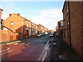
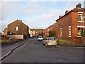
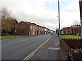
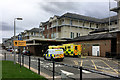
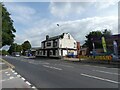
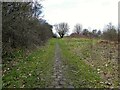
38 photos from this area
Area Information
Key information about the OL2 5AP including its size, population, and administrative classification.
- Area Type
- Postcode
- Area Size
- 2405 m²
- Population
- 1585
- Population Density
- 3556 people/km²
House Prices in OL2 5AP
11
Properties
£133,150
Average Sold Price
£46,000
Lowest Price
£490,000
Highest Price
Showing 11 properties
| Address | Type | Beds | Baths | Last Sale Price | Last Sale Date | |
|---|---|---|---|---|---|---|
| 4 Harry Street, Royton, OL2 5AP | house | - | - | £490,000 | Sep 2023 | |
| 9 Harry Street, Royton, OL2 5AP | house | - | - | £122,250 | Aug 2021 | |
| 5 Harry Street, Royton, OL2 5AP | house | - | - | £95,000 | Apr 2020 | |
| 1 Harry Street, Royton, OL2 5AP | house | - | - | £69,950 | Sep 2016 | |
| 3 Harry Street, Royton, OL2 5AP | Terraced | 2 | 1 | £88,000 | Jan 2011 | |
| 7 Harry Street, Royton, OL2 5AP | Terraced | - | - | £82,000 | Nov 2005 | |
| 11 Harry Street, Royton, OL2 5AP | Terraced | - | - | £72,000 | Jun 2004 | |
| 8 Harry Street, Royton, OL2 5AP | house | - | - | £46,000 | May 2002 | |
| 10 Harry Street, Royton, OL2 5AP | Semi-detached | 3 | - | - | - | |
| 6 Harry Street, Royton, OL2 5AP | Semi-detached | - | - | - | - |
Page 1 of 2
Energy Efficiency in OL2 5AP
Amenities
Schools
| Rank | School | Type | Entry gender | Ages |
|---|
Explore more schools in this area
Go to Schools tabDemographics
Household Size
Two person
most common
Accommodation Type
Houses
most common
Tenure
90
majority
Ethnic Group
White
most common
Religion
N/A
most common
Household Composition
N/A
most common
Age
47
median
Adults (30-64 years)
most common
Household Deprivation
N/A
with no deprivation
NS-SEC
34
in Lower managerial occupations
Explore more demographic insights in this area
Go to Demographics tabPlanning
Planning Constraints
- Flood RiskPremium
- Ramsar Wetland SitesPremium
- Area of Outstanding Natural BeautyPremium
- Protected Nature ReservePremium
- Protected WoodlandPremium