Area Overview for OL16 3QZ
Photos of OL16 3QZ
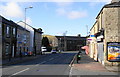
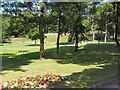
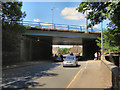
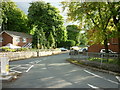
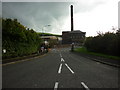
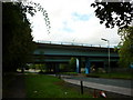
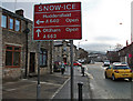
100 photos from this area
Area Information
Key information about the OL16 3QZ including its size, population, and administrative classification.
- Area Type
- Postcode
- Area Size
- 2.1 hectares
- Population
- 1412
- Population Density
- 119 people/km²
House Prices in OL16 3QZ
29
Properties
£97,352
Average Sold Price
£26,500
Lowest Price
£144,950
Highest Price
Showing 29 properties
| Address | Type | Beds | Baths | Last Sale Price | Last Sale Date | |
|---|---|---|---|---|---|---|
| 75 Huddersfield Road, Milnrow, OL16 3QZ | Terraced | 2 | 1 | £135,000 | Nov 2023 | |
| 69 Huddersfield Road, Milnrow, OL16 3QZ | Terraced | 2 | 1 | £122,000 | Oct 2023 | |
| 53 Huddersfield Road, Milnrow, OL16 3QZ | Terraced | 2 | 1 | £110,000 | Sep 2023 | |
| 55 Huddersfield Road, Milnrow, OL16 3QZ | Terraced | 2 | 1 | £105,000 | Jun 2023 | |
| 49 Huddersfield Road, Milnrow, OL16 3QZ | house | 2 | - | £144,950 | Jan 2023 | |
| 63 Huddersfield Road, Milnrow, OL16 3QZ | house | - | - | £125,000 | Jul 2022 | |
| 71 Huddersfield Road, Milnrow, OL16 3QZ | house | - | - | £100,000 | Nov 2021 | |
| 51 Huddersfield Road, Milnrow, OL16 3QZ | Terraced | 2 | 1 | £122,000 | Nov 2019 | |
| 37 Huddersfield Road, Milnrow, OL16 3QZ | Terraced | 2 | - | £120,000 | Jul 2018 | |
| 81 Huddersfield Road, Milnrow, OL16 3QZ | Terraced | 2 | - | £87,500 | Mar 2014 |
Page 1 of 3
Energy Efficiency in OL16 3QZ
Amenities
Schools
| Rank | School | Type | Entry gender | Ages |
|---|
Explore more schools in this area
Go to Schools tabDemographics
Household Size
Two person
most common
Accommodation Type
Houses
most common
Tenure
69
majority
Ethnic Group
White
most common
Religion
N/A
most common
Household Composition
N/A
most common
Age
47
median
Adults (30-64 years)
most common
Household Deprivation
N/A
with no deprivation
NS-SEC
35
in Lower managerial occupations
Explore more demographic insights in this area
Go to Demographics tabPlanning
Planning Constraints
- Flood RiskPremium
- Ramsar Wetland SitesPremium
- Area of Outstanding Natural BeautyPremium
- Protected Nature ReservePremium
- Protected WoodlandPremium