Area Overview for OL16 3JF
Photos of OL16 3JF
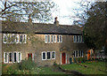
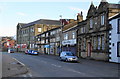
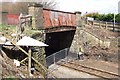
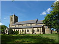
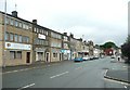
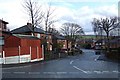
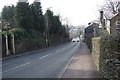
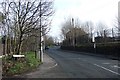
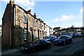
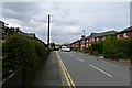
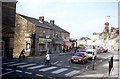
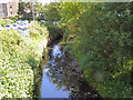
100 photos from this area
Area Information
Key information about the OL16 3JF including its size, population, and administrative classification.
- Area Type
- Postcode
- Area Size
- 8958 m²
- Population
- 1528
- Population Density
- 3286 people/km²
House Prices in OL16 3JF
9
Properties
£195,400
Average Sold Price
£46,000
Lowest Price
£565,000
Highest Price
Showing 9 properties
| Address | Type | Beds | Baths | Last Sale Price | Last Sale Date | |
|---|---|---|---|---|---|---|
| Kiln Bank, Kiln Lane, Milnrow, OL16 3JF | Detached | 5 | 2 | £230,000 | Jan 2024 | |
| St James House, Kiln Lane, Milnrow, OL16 3JF | house | - | - | £565,000 | Aug 2020 | |
| 18 Kiln Lane, Milnrow, OL16 3JF | Semi-detached | 2 | 1 | £78,000 | May 2015 | |
| 23 Kiln Lane, Milnrow, OL16 3JF | house | - | - | £58,000 | Nov 2005 | |
| 16 Kiln Lane, Milnrow, OL16 3JF | Cottage | 2 | 1 | £46,000 | Jun 2000 | |
| 12 Kiln Lane, Milnrow, OL16 3JF | Semi-detached | - | - | - | - | |
| 21 Kiln Lane, Milnrow, OL16 3JF | Semi-detached | - | - | - | - | |
| 14 Kiln Lane, Milnrow, OL16 3JF | Semi-detached | - | - | - | - | |
| J Warburton And Sons, Kiln Lane, Milnrow, OL16 3JF | Industrial | - | - | - | - |
Energy Efficiency in OL16 3JF
Amenities
Schools
| Rank | School | Type | Entry gender | Ages |
|---|
Explore more schools in this area
Go to Schools tabDemographics
Household Size
Two person
most common
Accommodation Type
Houses
most common
Tenure
68
majority
Ethnic Group
White
most common
Religion
N/A
most common
Household Composition
N/A
most common
Age
47
median
Adults (30-64 years)
most common
Household Deprivation
N/A
with no deprivation
NS-SEC
33
in Lower managerial occupations
Explore more demographic insights in this area
Go to Demographics tabPlanning
Planning Constraints
- Flood RiskPremium
- Ramsar Wetland SitesPremium
- Area of Outstanding Natural BeautyPremium
- Protected Nature ReservePremium
- Protected WoodlandPremium