Area Overview for OL16 2YZ
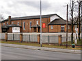
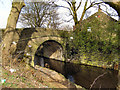
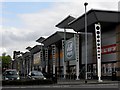
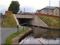
Photos of OL16 2YZ


Area Information
OL16 2YZ serves as a specific postcode area covering a small residential cluster within Greater Manchester, England. The community contains a population of 1567 residents, creating a tight-knit environment where neighbours often know one another. This locality functions as a quiet residential exception to the larger, more industrial character of the surrounding Rochdale region. Living in OL16 2YZ offers a distinct separation from the heavier traffic and commerce found just a few minutes away at the Newbold and Kingsway Business Park. The area sits close to the Rochdale Interchange, providing access to wider transport networks without the immediate noise of through traffic. Daily life here revolves around proximity to established retail hubs and business zones. You will find yourself just steps away from major employment sites like the Kingsway Business Park and the quieter Newbold area. This location provides a balance between the convenience of urban commerce and the relative quiet of a residential cluster. The small scale of the population means that infrastructure is used efficiently, creating a less congested environment than nearby towns. As a postcode defined by its density and specific location, OL16 2YZ represents a practical choice for those seeking sheltered housing near significant transport links without living directly in the busiest commercial centres. The area maintains a functional character, prioritising residence and access over high-end leisure or tourism.
- Area Type
- Postcode
- Area Size
- Not available
- Population
- 1567
- Population Density
- 3137 people/km²
The property market in OL16 2YZ is characterised by a strong preference for owner-occupied housing. Statistics show that 57% of residents own their homes, indicating that this is primarily an estate for long-term living rather than transient rental accommodation. The accommodation type is strictly houses, meaning you will not find any flats or apartment buildings within the OL16 2YZ boundary. This focus on standalone housing typically appeals to buyers seeking privacy and garden space, which aligns with the mature age profile of the area. For buyers looking at homes in OL16 2YZ, the market reflects a community where residents are deeply rooted. The small cluster nature of the postcode suggests that inventory may be limited compared to larger towns, but the quality of the stock is consistent with the age of the occupants. Most transactions involve existing owners selling to another stable household rather than investment buyers entering the rental market. This dynamic creates a neighbourhood where property values are likely supported by local attachment rather than speculative growth. When considering purchases near this postcode, you are choosing a traditional residential setting without the mixed-use complexity of town centres. The housing stock is designed for families and individuals rather than multi-tenant buildings.
House Prices in OL16 2YZ
No properties found in this postcode.
Energy Efficiency in OL16 2YZ
Living in OL16 2YZ offers practical convenience through access to five key metro areas and five major retail destinations. You are situated near Newbold, Kingsway Business Park, and the Rochdale Interchange, providing easy routes to employment hubs. For daily shopping, Morrisons Belfield, Asda Rochdale, and Aldi Entwisle are all within practical reach, ensuring you can handle all your grocery and household needs without travelling far. Five railway stations are also nearby, including Rochdale Railway Station, Smithy Bridge Railway Station, and Littleborough Railway Station, giving you flexibility in your daily commute. Your lifestyle is supported by a dense network of essential services located just a short drive from your home. The presence of these five retail outlets means you do not need to venture into distant towns for supermarkets, allowing for quick, efficient errands. The nearby business parks and industrial estates mean that if you work locally, your journey will be short and predictable. This concentration of amenities creates a self-sufficient environment where the basics of life are handled within the Rochdale perimeter. You can manage family budgets, social visits, and shopping trips using the local infrastructure without the pressure of long commutes. The area functions as an efficient satellite to the larger town, prioritising utility over leisure.
Amenities
Schools
Families considering schools near OL16 2YZ have very limited options within the immediate post-code proximity. The only educational institution listed for this area is the Rochdale Pupil Referral Service. This facility operates as an alternative provision setting for students aged 11 to 19, rather than a standard primary or secondary school. Its existence within the local listing suggests that this specific cluster contains no primary catchment zones or standard state schools. The absence of primary or secondary schools means that children living in OL16 2YZ will almost certainly attend institutions further away in the broader Rochdale region. Parents must look beyond the immediate postcode for education, which is a standard pattern for small residential clusters in Greater Manchester. The presence of a Pupil Referral Service nearby indicates that the wider area has a mechanism for alternative education, though this does not impact mainstream school choices. When comparing OL16 2YZ to larger neighbourhoods, the lack of local schooling is a defining constraint. You will need to commute to larger town centres like Rochdale Interchange to access formal education facilities. This reality shapes daily routines for parents, as dropping off children often requires driving distances that are not absorbed by local amenities.
| Rank | School | Type | Entry gender | Ages |
|---|
Explore more schools in this area
Go to Schools tabDemographics
The community in OL16 2YZ is defined by a mature and stable resident base. You will find that the median age is 47 years, with the most common age range falling between 30 and 64 years. This demographic profile indicates a neighbourhood populated by adults likely to be in their retirement years or approaching it, rather than families with young children. Consequently, the social pace is generally settled, reflecting the needs and routines of working professionals and retirees alike. Home stability is high within this cluster, where 57% of residents own their homes outright or have significant equity. This ownership rate suggests a long-term commitment to the locality and a community invested in its maintenance. The accommodation type is exclusively houses, confirming that no apartments or flats are present within this specific postcode boundary. Instead, you are looking at a stock of detached or semi-detached properties suited for individual households. The predominant ethnic group in the area is Asian, adding a specific cultural dimension to the local identity. This diversity is woven into the fabric of the 1567 residents who call this postal district home, creating a distinct demographic signature separate from surrounding districts.
Household Size
Accommodation Type
Tenure
Ethnic Group
Religion
Household Composition
Age
Household Deprivation
NS-SEC
Explore more demographic insights in this area
Go to Demographics tabPlanning
Planning Constraints
- Flood RiskPremium
- Ramsar Wetland SitesPremium
- Area of Outstanding Natural BeautyPremium
- Protected Nature ReservePremium
- Protected WoodlandPremium