Area Overview for OL16 2TU
Photos of OL16 2TU
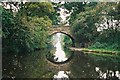
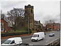
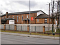
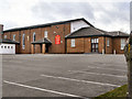
60 photos from this area
Area Information
Key information about the OL16 2TU including its size, population, and administrative classification.
- Area Type
- Postcode
- Area Size
- 1.7 hectares
- Population
- 1861
- Population Density
- 5124 people/km²
House Prices in OL16 2TU
53
Properties
£116,667
Average Sold Price
£70,000
Lowest Price
£202,000
Highest Price
Showing 53 properties
| Address | Type | Beds | Baths | Last Sale Price | Last Sale Date | |
|---|---|---|---|---|---|---|
| 127 Bellshill Crescent, Rochdale, OL16 2TU | Semi-detached | 3 | 1 | £155,000 | Aug 2023 | |
| 97 Bellshill Crescent, Rochdale, OL16 2TU | Semi-detached | 3 | 1 | £70,000 | Jul 2023 | |
| 88 Bellshill Crescent, Rochdale, OL16 2TU | house | - | - | £160,000 | May 2022 | |
| 131 Bellshill Crescent, Rochdale, OL16 2TU | house | - | - | £140,000 | Jul 2021 | |
| 141 Bellshill Crescent, Rochdale, OL16 2TU | house | - | - | £202,000 | May 2021 | |
| 78 Bellshill Crescent, Rochdale, OL16 2TU | Semi-detached | 3 | 2 | £101,000 | Oct 2018 | |
| 76 Bellshill Crescent, Rochdale, OL16 2TU | house | - | - | £70,000 | Jan 2013 | |
| 151 Bellshill Crescent, Rochdale, OL16 2TU | house | - | - | £80,000 | Oct 2011 | |
| 153 Bellshill Crescent, Rochdale, OL16 2TU | house | - | - | £72,000 | Jan 2011 | |
| 111 Bellshill Crescent, Rochdale, OL16 2TU | Terraced | 3 | 1 | - | - |
Page 1 of 6
Energy Efficiency in OL16 2TU
Amenities
Schools
| Rank | School | Type | Entry gender | Ages |
|---|
Explore more schools in this area
Go to Schools tabDemographics
Household Size
Family (3-5 people)
most common
Accommodation Type
Houses
most common
Tenure
38
majority
Ethnic Group
asian_total
most common
Religion
N/A
most common
Household Composition
N/A
most common
Age
22
median
Adults (30-64 years)
most common
Household Deprivation
N/A
with no deprivation
NS-SEC
8
in Lower managerial occupations
Explore more demographic insights in this area
Go to Demographics tabPlanning
Planning Constraints
- Flood RiskPremium
- Ramsar Wetland SitesPremium
- Area of Outstanding Natural BeautyPremium
- Protected Nature ReservePremium
- Protected WoodlandPremium