Area Overview for OL16 2TG
Photos of OL16 2TG
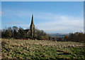
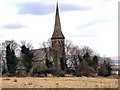
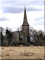
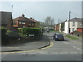
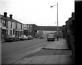
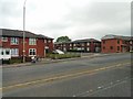
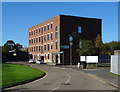
44 photos from this area
Area Information
Key information about the OL16 2TG including its size, population, and administrative classification.
- Area Type
- Postcode
- Area Size
- 3410 m²
- Population
- 1973
- Population Density
- 6652 people/km²
House Prices in OL16 2TG
12
Properties
£56,150
Average Sold Price
£39,600
Lowest Price
£75,000
Highest Price
Showing 12 properties
| Address | Type | Beds | Baths | Last Sale Price | Last Sale Date | |
|---|---|---|---|---|---|---|
| 63 Roch Street, Rochdale, OL16 2TG | Terraced | 2 | - | £60,000 | Jul 2019 | |
| 53 Roch Street, Rochdale, OL16 2TG | house | - | - | £75,000 | Sep 2008 | |
| 47 Roch Street, Rochdale, OL16 2TG | Terraced | - | - | £50,000 | Jul 2006 | |
| 57 Roch Street, Rochdale, OL16 2TG | Terraced | - | - | £39,600 | Apr 2006 | |
| 65 Roch Street, Rochdale, OL16 2TG | Semi-detached | - | - | - | - | |
| 55 Roch Street, Rochdale, OL16 2TG | house | - | - | - | - | |
| 51 Roch Street, Rochdale, OL16 2TG | Terraced | - | - | - | - | |
| 49 Roch Street, Rochdale, OL16 2TG | house | - | - | - | - | |
| 45 Roch Street, Rochdale, OL16 2TG | house | - | - | - | - | |
| 61 Roch Street, Rochdale, OL16 2TG | Terraced | - | - | - | - |
Page 1 of 2
Energy Efficiency in OL16 2TG
Amenities
Schools
| Rank | School | Type | Entry gender | Ages |
|---|
Explore more schools in this area
Go to Schools tabDemographics
Household Size
Family (3-5 people)
most common
Accommodation Type
Houses
most common
Tenure
39
majority
Ethnic Group
asian_total
most common
Religion
N/A
most common
Household Composition
N/A
most common
Age
47
median
Adults (30-64 years)
most common
Household Deprivation
N/A
with no deprivation
NS-SEC
14
in Lower managerial occupations
Explore more demographic insights in this area
Go to Demographics tabPlanning
Planning Constraints
- Flood RiskPremium
- Ramsar Wetland SitesPremium
- Area of Outstanding Natural BeautyPremium
- Protected Nature ReservePremium
- Protected WoodlandPremium