Area Overview for OL16 2QT
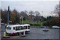
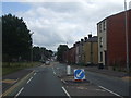
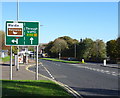
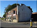
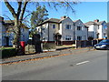
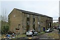
Photos of OL16 2QT


Area Information
Living in OL16 2QT means residing within a specific postcode cluster in the Greater Manchester region of England. This small residential area forms part of a larger community characterised by its proximity to key transport hubs. The population stands at 2,156 residents, creating a neighbourhood with a sense of established permanence rather than transient occupancy. Population density reaches 1,587 people per square kilometre, which maintains a relatively close-knit feel despite the small total headcount. Life here revolves around practical convenience, with access to major retail chains and rail stations situated within practical reach. You will find yourself in a setting where daily commutes and local errands are manageable without excessive travel time. The area operates independently yet remains connected to the wider Rochdale infrastructure through nearby motorways and road networks. There are no protected natural constraints like AONBs or Ramsar sites affecting planning, allowing for standard development patterns typical of the local housing stock. The environment is defined by its functional layout, prioritising access to essentials and transport links over expansive green spaces. Residents navigate a landscape where the balance between privacy and community interaction is dictated by the housing density and street design common to this postcode.
- Area Type
- Postcode
- Area Size
- Not available
- Population
- 2156
- Population Density
- 1587 people/km²
The property market in OL16 2QT is defined by a substantial owner-occupied base. Eighty-two percent of homes are owned by residents, indicating that the market is less driven by short-term letting compared to rental-heavy cities. Houses form the primary accommodation type, meaning you will predominantly encounter detached, semi-detached, or terraced family homes rather than apartments or flats. This house-dominant stock appeals to buyers seeking traditional British residential living with gardens and private access. The low density implied by the specific postcode cluster suggests a quieter environment compared to dense urban centres. Because most residents own their homes, price fluctuations may reflect individual property labour rather than high turnover. There is little evidence of luxury or high-end speculative development, as the footprint is a small residential cluster. Buyers should expect a market where property values are anchored by established tenure rates. The concentration of houses means less competition for ground-level flats, which may affect rental yields if you were to consider investment purposes. The market appears stable, driven by local demand rather than foreign investment or transient movers.
House Prices in OL16 2QT
No properties found in this postcode.
Energy Efficiency in OL16 2QT
Residents of OL16 2QT benefit from a compact range of amenities within practical reach. Your daily conveniences include five retail options, notably Spar, Iceland Rochdale 2, and Asda Rochdale. These stores cover essentials from fresh groceries to housewares. Transport hubs are equally accessible, with five rail stations nearby including Smithy Bridge Railway Station, Littleborough Railway Station, and Rochdale Railway Station. These stations offer connections to wider Manchester networks. Additionally, five metro or bus interchange points such as Newbold, Rochdale Interchange, and Rochdale Town Centre provide frequent public transport links. Shopping needs are met without needing to travel far to the nearest town centre. Goods availability at Iceland and Asda suggests high-quality supply chains reach this postcode. The concentration of retail and transport nodes implies a lifestyle focused on efficiency and accessibility. You can manage household logistics while maintaining easy access to the broader cultural and social activities of Rochdale. The specific naming of Rochdale 2 indicates multiple access points to the town centre services.
Amenities
Schools
Families living in OL16 2QT have access to specific educational establishments within their immediate vicinity. Two primary schools are located nearby: St Andrew's Church of England Primary School, Dearnley, and St Andrew's Church of England Primary School and Nursery. Both institutions operate on the state-funded primary education system. These are Church of England schools, which may influence the ethos and admissions criteria for prospective pupils. No secondary schools are listed in the immediate proximity data for this postcode. This arrangement means parents must transport children to secondary education facilities further away from the cluster. The presence of nurseries attached to one of the primary schools provides convenience for younger children. The specific naming convention of St Andrew's suggests a local heritage tied to the Dearnley area. For residents prioritising education, the proximity of these specific sibling schools offers a consolidated learning environment. You should verify current Ofsted ratings directly via government portals as they are not provided in the source data. The limitation of listed schools indicates that high-value secondary options are not adjacent to this specific small residential cluster.
| Rank | School | Type | Entry gender | Ages |
|---|
Explore more schools in this area
Go to Schools tabDemographics
The community profile of OL16 2QT reflects an area dominated by mature adults. The median age is 47, with the most common age range falling between 30 and 64 years. This demographic skew suggests a population comprising families, established professionals, and older residents who have put down roots. Home ownership is prevalent, with 82% of residents owning their properties outright or with a mortgage. This high ownership rate indicates stability and long-term settlement rather than a transient rental market. The predominant accommodation type consists of houses, which aligns with the preference for greater space and autonomy found in the area. Demographic composition shows a significant White ethnic group as the majority, typical of many established residential clusters across the region. While specific poverty or deprivation indices are not listed in the current dataset, the demographics suggest a community focused on stability. None of the remaining residents in this cluster are part of other ethnic groups, pointing towards a homogenous population structure. The absence of data on specific deprivation metrics means you cannot quantify economic hardship, but the high ownership rate usually correlates with financial stability in wider housing markets.
Household Size
Accommodation Type
Tenure
Ethnic Group
Religion
Household Composition
Age
Household Deprivation
NS-SEC
Explore more demographic insights in this area
Go to Demographics tabPlanning
Planning Constraints
- Flood RiskPremium
- Ramsar Wetland SitesPremium
- Area of Outstanding Natural BeautyPremium
- Protected Nature ReservePremium
- Protected WoodlandPremium