Area Overview for OL16 2JZ
Photos of OL16 2JZ

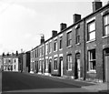
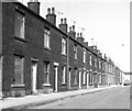
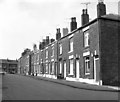
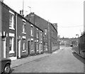
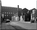
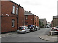
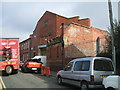
62 photos from this area
Area Information
Key information about the OL16 2JZ including its size, population, and administrative classification.
- Area Type
- Postcode
- Area Size
- 5472 m²
- Population
- 1667
- Population Density
- 7007 people/km²
House Prices in OL16 2JZ
25
Properties
£38,467
Average Sold Price
£5,000
Lowest Price
£70,000
Highest Price
Showing 25 properties
| Address | Type | Beds | Baths | Last Sale Price | Last Sale Date | |
|---|---|---|---|---|---|---|
| 100 Oswald Street, Rochdale, OL16 2JZ | Terraced | 3 | 1 | £33,500 | Nov 2021 | |
| 73 Oswald Street, Rochdale, OL16 2JZ | house | - | - | £52,500 | Apr 2020 | |
| 96 Oswald Street, Rochdale, OL16 2JZ | house | - | - | £50,000 | Jul 2014 | |
| 98 Oswald Street, Rochdale, OL16 2JZ | house | - | - | £43,200 | Feb 2013 | |
| 67 Oswald Street, Rochdale, OL16 2JZ | Terraced | - | - | £70,000 | Feb 2005 | |
| 106 Oswald Street, Rochdale, OL16 2JZ | house | - | - | £33,000 | Nov 2001 | |
| 74 Oswald Street, Rochdale, OL16 2JZ | Terraced | - | - | £5,000 | Jul 2000 | |
| 78 Oswald Street, Rochdale, OL16 2JZ | house | - | - | £31,000 | Oct 1997 | |
| 92 Oswald Street, Rochdale, OL16 2JZ | Terraced | - | - | £28,000 | Dec 1996 | |
| 69 Oswald Street, Rochdale, OL16 2JZ | Terraced | 2 | 1 | - | - |
Page 1 of 3
Energy Efficiency in OL16 2JZ
Amenities
Schools
| Rank | School | Type | Entry gender | Ages |
|---|
Explore more schools in this area
Go to Schools tabDemographics
Household Size
Family (3-5 people)
most common
Accommodation Type
Houses
most common
Tenure
44
majority
Ethnic Group
asian_total
most common
Religion
N/A
most common
Household Composition
N/A
most common
Age
22
median
Adults (30-64 years)
most common
Household Deprivation
N/A
with no deprivation
NS-SEC
14
in Lower managerial occupations
Explore more demographic insights in this area
Go to Demographics tabPlanning
Planning Constraints
- Flood RiskPremium
- Ramsar Wetland SitesPremium
- Area of Outstanding Natural BeautyPremium
- Protected Nature ReservePremium
- Protected WoodlandPremium