Area Overview for OL15 8AL
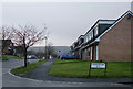
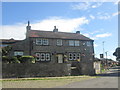
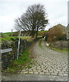
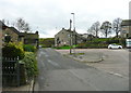
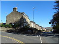
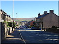
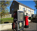
Photos of OL15 8AL


Area Information
Living in OL15 8AL offers a dense residential experience within a very small geographic footprint. This specific postcode covers an area of just 1,701 square metres, creating a compact cluster where daily life revolves around immediate neighbours. You are part of a community of 1,548 people, resulting in an extremely high population density of 910,064 people per square kilometre. While this figure presents an unusual statistical outcome for a specific post code, it reflects the intense concentration of households in this urban pocket. The setting is distinctly residential, dominated by houses rather than high-rise blocks or mixed-use developments. Daily life here involves navigating a tight-knit environment where space at ground level is at a premium. Residents benefit from being centrally located within Greater Manchester, providing quick access to wider transport networks despite the limited local land area. This postcode represents a slice of urban living where proximity defines the experience, carrying the character of a established residential cluster within the broader Stockport or Rochdale corridor.
- Area Type
- Postcode
- Area Size
- 1701 m²
- Population
- 1548
- Population Density
- 3462 people/km²
The property market in OL15 8AL is overwhelmingly owner-occupied, with 81 per cent of homes held by their owners. This high percentage distinguishes the area from typical student hubs or rental zones common in larger city centres. The housing stock is dominated by houses, meaning you will find terraced, semi-detached, or detached properties rather than flats or converted lofts. Because the area is a small residential cluster of only 1,701 square metres, supply is naturally limited, which can influence local pricing dynamics. Buyers looking at homes in OL15 8AL should expect to enter a market where sellers are often motivated by life changes rather than investment flipping. The concentration of households means competition can be fierce if there are few specific listings that match your criteria. This is not an area for those seeking a new-build inventory or a purchasing market with frequent transactional movement. Instead, the market reflects long-term retention and local knowledge among both buyers and agents. Your focus should be on securing an existing property within this tight cluster rather than anticipating major developments.
House Prices in OL15 8AL
Showing 6 properties
| Address | Type | Beds | Baths | Last Sale Price | Last Sale Date | |
|---|---|---|---|---|---|---|
| 2 James William Street, Littleborough, OL15 8AL | Semi-detached | 3 | 1 | £166,000 | Apr 2021 | |
| 4 James William Street, Littleborough, OL15 8AL | Semi-detached | 3 | 2 | £124,495 | Dec 2014 | |
| 8 James William Street, Littleborough, OL15 8AL | Semi-detached | 3 | 2 | £137,000 | Jun 2014 | |
| 6 James William Street, Littleborough, OL15 8AL | Semi-detached | 3 | 2 | £134,000 | Jun 2014 | |
| 10 James William Street, Littleborough, OL15 8AL | Semi-detached | 3 | 2 | £125,000 | Mar 2014 | |
| 12 James William Street, Littleborough, OL15 8AL | Terraced | 3 | 2 | £138,800 | Sep 2013 |
Energy Efficiency in OL15 8AL
Residents of OL15 8AL have practical access to a range of retail and transport options within easy reach. For daily shopping, you can visit Spar, Lidl Stockton Street, or Sainsburys Littleborough, providing a choice of supermarkets close by. Five retail venues are located nearby, ensuring you do not need to travel far for groceries or essentials. Transport connectivity is supported by several railway stations, including Smithy Bridge Railway Station, Littleborough Railway Station, and Rochdale Railway Station. These five rail links allow you to connect to wider city centres or regional hubs efficiently. In terms of local business and employment zones, Kingsway Business Park, Newbold, and Milnrow are situated nearby, offering professional environments just a short commute away. While the postcode area itself is small, these surrounding amenities create a functional lifestyle. You will find the convenience of large supermarkets and reliable train networks integrated into your standard routine. This layout supports a balance between residential calm and accessible urban facilities.
Amenities
Schools
| Rank | School | Type | Entry gender | Ages |
|---|
Explore more schools in this area
Go to Schools tabDemographics
The community in OL15 8AL consists of mature adults, with a median age of 47 years. The majority of residents fall into the 30 to 64-year-old bracket, indicating an area populated by families, established couples, and perhaps some recent retirees. Home ownership stands at 81 per cent, suggesting a stable neighbourhood where long-term residents have secured tenure rather than renting. The prevailing accommodation type is houses, aligning with the age profile and ownership rates. Ethnic diversity is predominantly White, shaping the cultural fabric of the local groups. This demographic structure implies a quiet, settled atmosphere rather than a transient student or young professional scene. The high rate of home ownership typically correlates with lower household turnover and consistent community engagement. Residents are likely focused on family needs or financial stability rather than short-term rentals. The absence of significant youth or elderly outliers points to a mid-life demographic draw. This profile supports a community driven by stability, where neighbours know each other and local institutions serve a settled population.
Household Size
Accommodation Type
Tenure
Ethnic Group
Religion
Household Composition
Age
Household Deprivation
NS-SEC
Explore more demographic insights in this area
Go to Demographics tabPlanning
Planning Constraints
- Flood RiskPremium
- Ramsar Wetland SitesPremium
- Area of Outstanding Natural BeautyPremium
- Protected Nature ReservePremium
- Protected WoodlandPremium