Area Overview for OL13 9QR
Photos of OL13 9QR
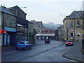
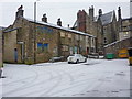
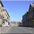
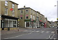
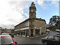
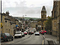
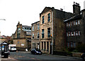
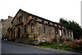
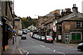
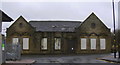
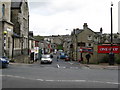
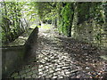
100 photos from this area
Area Information
Key information about the OL13 9QR including its size, population, and administrative classification.
- Area Type
- Postcode
- Area Size
- 2825 m²
- Population
- 1324
- Population Density
- 3168 people/km²
House Prices in OL13 9QR
23
Properties
£44,441
Average Sold Price
£14,720
Lowest Price
£84,950
Highest Price
Showing 23 properties
| Address | Type | Beds | Baths | Last Sale Price | Last Sale Date | |
|---|---|---|---|---|---|---|
| 19 Bold Street, Bacup, OL13 9QR | house | 3 | - | £60,000 | May 2020 | |
| 7 Bold Street, Bacup, OL13 9QR | Terraced | 3 | 1 | £84,950 | Apr 2019 | |
| 13 Bold Street, Bacup, OL13 9QR | Terraced | 2 | 1 | £60,000 | Apr 2019 | |
| 15 Bold Street, Bacup, OL13 9QR | house | - | - | £54,000 | May 2017 | |
| 21 Bold Street, Bacup, OL13 9QR | Terraced | 2 | 1 | £38,000 | Apr 2017 | |
| 1 Bold Street, Bacup, OL13 9QR | Terraced | 3 | 1 | £40,000 | Mar 2017 | |
| 10 Bold Street, Bacup, OL13 9QR | Terraced | 2 | 1 | £36,000 | Oct 2016 | |
| 25 Bold Street, Bacup, OL13 9QR | house | - | - | £81,500 | Aug 2007 | |
| 4 Bold Street, Bacup, OL13 9QR | Terraced | - | - | £45,000 | Mar 2006 | |
| 12 Bold Street, Bacup, OL13 9QR | Terraced | - | - | £37,950 | Jan 2004 |
Page 1 of 3
Energy Efficiency in OL13 9QR
Amenities
Schools
| Rank | School | Type | Entry gender | Ages |
|---|
Explore more schools in this area
Go to Schools tabDemographics
Household Size
One person
most common
Accommodation Type
Houses
most common
Tenure
43
majority
Ethnic Group
White
most common
Religion
N/A
most common
Household Composition
N/A
most common
Age
47
median
Adults (30-64 years)
most common
Household Deprivation
N/A
with no deprivation
NS-SEC
22
in Lower managerial occupations
Explore more demographic insights in this area
Go to Demographics tabPlanning
Planning Constraints
- Flood RiskPremium
- Ramsar Wetland SitesPremium
- Area of Outstanding Natural BeautyPremium
- Protected Nature ReservePremium
- Protected WoodlandPremium