Area Overview for OL13 8RX
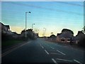
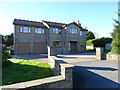
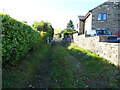
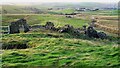
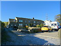
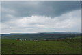
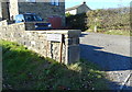
Photos of OL13 8RX

Area Information
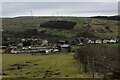
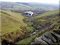
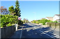
Living in OL13 8RX offers a settled residential life within a compact 4.4-hectare cluster. This specific postcode serves a small population of 1,852 people, maintaining a population density of 213 people per square kilometre. The area functions as a quiet, neighbourhood-focused environment rather than a bustling commercial hub. You will find close-knit streets where daily life revolves around local proximity and familiar surroundings. The sheer small size of the estate means you can easily walk to the main points of interest without excessive travel. Residents here value stability, reflected in the quiet, house-dominated landscape. The area avoids the chaos of larger urban sprawls while still providing essential services nearby. You are situated in a community that prioritises peace and space over high-density living. The low footprint of the estate means you are not Competing with mass developers for land in this immediate vicinity. Instead, you inhabit a space defined by its exclusivity and manageable scale. For those seeking a home away from a chaotic commercial centre, this postcode delivers a calm setting. The neighbourhood feels interwoven with the wider town of Rawtenstall, yet it retains its own distinct, smaller identity. You can enjoy the benefits of being part of a larger region while living in a contained environment. This balance defines the OL13 8RX living experience. You gain access to broader networks without sacrificing the quiet found within this specific residential zone.
- Area Type
- Postcode
- Area Size
- 4.4 hectares
- Population
- 1852
- Population Density
- 213 people/km²
The property market in OL13 8RX is overwhelmingly defined by owner occupancy. With 83% home ownership levels, the area is explicitly owner-led rather than a rental market. You will find that the vast majority of homes are occupied by their owners, either married couples or families who have lived there for many years. The dominant accommodation type is houses, which align perfectly with the high rate of ownership. This housing configuration suggests a market driven by family needs and long-term investment rather than transient letting. Small areas like this postcode often serve as desired locations for first-time buyers moving up the ladder or families seeking more space. The prevalence of houses over flats indicates that single-storey or two-storey family homes are the standard. You should expect a market where properties change hands occasionally, but the core stock remains stable. This stability means that estate agents in the region tend to list properties for families or older buyers rather than students or short-term renters. The high ownership figure implies strong local attachment to OL13 8RX. Buyers purchasing homes here are often looking for a permanent base. This character makes the area less volatile than typical urban rental zones. When viewing homes in this postcode, you will see properties well cared for by owners who aim to maintain a fully realised home. The market reflects a community where people build roots rather than temporary leases.
House Prices in OL13 8RX
Showing 5 properties
| Address | Type | Beds | Baths | Last Sale Price | Last Sale Date | |
|---|---|---|---|---|---|---|
| Lower Doals House, Hillside Crescent, Weir, Bacup, OL13 8RX | house | - | - | £365,000 | Dec 2021 | |
| 1-2, Doals Farm, Hillside Crescent, Weir, Bacup, OL13 8RX | Detached | 3 | 1 | - | - | |
| Doals House, Hillside Crescent, Weir, Bacup, OL13 8RX | house | 3 | 1 | - | - | |
| Doals Stables, Hillside Crescent, Weir, Bacup, OL13 8RX | Detached | - | - | - | - | |
| Caravan, Doals Stables, Hillside Crescent, Weir, Bacup, OL13 8RX | Mobile Home | - | - | - | - |
Energy Efficiency in OL13 8RX
Your access to local amenities places shopping and services within convenient reach. You can visit Spar Bacup and Morrisons Newline, which serve as the nearest supermarkets. These five retail locations ensure you can stock up on essentials without travelling far. The presence of additional Spar outlets provides variety for your daily shopping needs. Transport connectivity extends to five rail stations and one Metro stop nearby. Rawtenstall Metro offers quick access to the town centre, while stations like Todmorden and Burnley Manchester Road connect you to wider networks. This diversity in transport choices means you can choose between driving, cycling, or public transport daily. The five available railway stations provide viable options for both leisure trips and essential business travel. Daily life in OL13 8RX blends convenience with the ability to reach broader opportunities quickly. The high density of transport nodes makes commuting manageable even in winter weather. You can enjoy the quiet of the residential estate yet step onto a train quickly when needed. The five noted train stations and one Metro stop ensure you are never truly isolated from the wider region's offerings. This balance of local retail and regional transport defines your lifestyle.
Amenities
Schools
Families living in OL13 8RX benefit from access to two nearby primary schools, both rated good by Ofsted. Northern Primary School serves young children in the area and holds a good rating. Sharneyford Primary School is the second nearby option and also carries a good Ofsted rating. The proximity of these two institutions means you have two established choices for compulsory primary education without needing to travel far. The mix of schools is strictly primary, as only primary institutions are listed in this dataset. There are no secondary or special needs schools within the immediate data provided for this specific educational ecosystem. This concentration on primary education suggests that families in this postcode often stay within the area for their children's early schooling years. Commuting distances to education are short, which saves time for parents and reduces the need for school-run vehicles. You may need to consider catchment areas for these two good-rated schools. Both Northern Primary School and Sharneyford Primary School offer a solid educational foundation. The absence of higher-level school data in this immediate context means that most residents will likely plan for secondary education further afield. However, the strong primary options provide a reliable starting point for children growing up in OL13 8RX. The consistency of 'good' ratings across the available schools adds confidence to the local educational offering.
| Rank | School | Type | Entry gender | Ages |
|---|
Explore more schools in this area
Go to Schools tabDemographics
The community in OL13 8RX reflects a mature, established population structure. The median age stands at 47 years, indicating that the most common residents are adults between the ages of 30 and 64. This age profile suggests a neighbourhood dominated by families with older children or mature home owners rather than young professionals or students. You will find a demographic that has chosen to settle permanently in the area, valuing long-term residence over short-term rental periods. Home ownership is the norm, with 83% of households owning their property outright or with a mortgage. This high rate signals a community deeply invested in the stability of OL13 8RX. You are unlikely to encounter a large transient population, as the vast majority of residents have a permanent stake in their homes. The prevailing accommodation type consists of houses, fitting the suburban character of the postcode. This housing style supports the family-oriented nature of the demographic found here. Ethnically, the area is predominantly White, creating a homogeneous community feel. The population density of 213 people per square kilometre ensures that while the area is not isolated, it does not feel overcrowded. You live in an environment where neighbours likely know each other, given the generational settlement patterns. This demographic configuration creates a predictable and stable social landscape. The mix of ages and household types supports a quiet, non-commercialised daily rhythm.
Household Size
Accommodation Type
Tenure
Ethnic Group
Religion
Household Composition
Age
Household Deprivation
NS-SEC
Explore more demographic insights in this area
Go to Demographics tabPlanning
Planning Constraints
- Flood RiskPremium
- Ramsar Wetland SitesPremium
- Area of Outstanding Natural BeautyPremium
- Protected Nature ReservePremium
- Protected WoodlandPremium