Area Overview for OL13 8RL
Photos of OL13 8RL
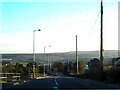
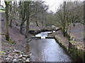
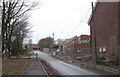
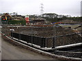
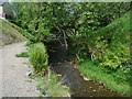
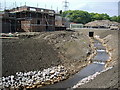
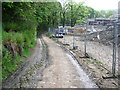
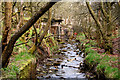
42 photos from this area
Area Information
Key information about the OL13 8RL including its size, population, and administrative classification.
- Area Type
- Postcode
- Area Size
- 7738 m²
- Population
- 1852
- Population Density
- 213 people/km²
House Prices in OL13 8RL
10
Properties
£336,656
Average Sold Price
£272,500
Lowest Price
£420,000
Highest Price
Showing 10 properties
| Address | Type | Beds | Baths | Last Sale Price | Last Sale Date | |
|---|---|---|---|---|---|---|
| 21 Beaufort Road, Weir, Bacup, OL13 8RL | Detached | 4 | 2 | £325,000 | Apr 2025 | |
| 17 Beaufort Road, Weir, Bacup, OL13 8RL | Detached | 4 | 2 | £385,000 | Jan 2023 | |
| 7 Beaufort Road, Weir, Bacup, OL13 8RL | Detached | 5 | 3 | £420,000 | Sep 2022 | |
| 3 Beaufort Road, Weir, Bacup, OL13 8RL | Detached | 5 | 3 | £352,500 | Apr 2021 | |
| 1 Beaufort Road, Weir, Bacup, OL13 8RL | Detached | 5 | 2 | £395,000 | Jan 2021 | |
| 15 Beaufort Road, Weir, Bacup, OL13 8RL | house | - | - | £280,000 | Aug 2018 | |
| 19 Beaufort Road, Weir, Bacup, OL13 8RL | Detached | 4 | 3 | £272,500 | Aug 2018 | |
| 5 Beaufort Road, Weir, Bacup, OL13 8RL | Detached | - | - | £299,950 | Sep 2007 | |
| 11 Beaufort Road, Weir, Bacup, OL13 8RL | Detached | 5 | 3 | £299,950 | Apr 2006 | |
| 9 Beaufort Road, Weir, Bacup, OL13 8RL | Detached | - | - | - | - |
Energy Efficiency in OL13 8RL
Amenities
Schools
| Rank | School | Type | Entry gender | Ages |
|---|
Explore more schools in this area
Go to Schools tabDemographics
Household Size
Family (3-5 people)
most common
Accommodation Type
Houses
most common
Tenure
83
majority
Ethnic Group
White
most common
Religion
N/A
most common
Household Composition
N/A
most common
Age
47
median
Adults (30-64 years)
most common
Household Deprivation
N/A
with no deprivation
NS-SEC
37
in Lower managerial occupations
Explore more demographic insights in this area
Go to Demographics tabPlanning
Planning Constraints
- Flood RiskPremium
- Ramsar Wetland SitesPremium
- Area of Outstanding Natural BeautyPremium
- Protected Nature ReservePremium
- Protected WoodlandPremium