Area Overview for OL12 9DY
Photos of OL12 9DY
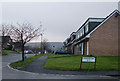
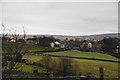
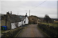
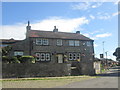
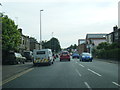
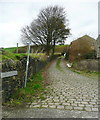
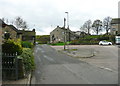
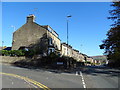
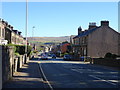
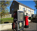
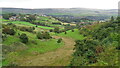
40 photos from this area
Area Information
Key information about the OL12 9DY including its size, population, and administrative classification.
- Area Type
- Postcode
- Area Size
- 4.0 hectares
- Population
- 1979
- Population Density
- 278 people/km²
House Prices in OL12 9DY
52
Properties
£192,246
Average Sold Price
£119,995
Lowest Price
£425,000
Highest Price
Showing 52 properties
| Address | Type | Beds | Baths | Last Sale Price | Last Sale Date | |
|---|---|---|---|---|---|---|
| 6 Oakley Way, Wardle, Rochdale, OL12 9DY | Detached | 3 | 2 | £260,000 | Oct 2025 | |
| 54 Oakley Way, Wardle, Rochdale, OL12 9DY | Semi-detached | 4 | 2 | £239,950 | Dec 2024 | |
| 19 Oakley Way, Wardle, Rochdale, OL12 9DY | house | - | - | £180,000 | Nov 2024 | |
| 28 Oakley Way, Wardle, Rochdale, OL12 9DY | house | - | - | £315,000 | Aug 2024 | |
| 16 Oakley Way, Wardle, Rochdale, OL12 9DY | Detached | 4 | 2 | £283,000 | Mar 2024 | |
| 2 Oakley Way, Wardle, Rochdale, OL12 9DY | Detached | 5 | - | £425,000 | Dec 2022 | |
| 12 Oakley Way, Wardle, Rochdale, OL12 9DY | Retail | 3 | 1 | £270,000 | May 2022 | |
| 66 Oakley Way, Wardle, Rochdale, OL12 9DY | Semi-detached | 3 | 2 | £205,000 | Mar 2022 | |
| 22 Oakley Way, Wardle, Rochdale, OL12 9DY | house | - | - | £254,000 | Nov 2021 | |
| 38 Oakley Way, Wardle, Rochdale, OL12 9DY | Semi-detached | 3 | 2 | £200,000 | Aug 2021 |
Page 1 of 6
Energy Efficiency in OL12 9DY
Amenities
Schools
| Rank | School | Type | Entry gender | Ages |
|---|
Explore more schools in this area
Go to Schools tabDemographics
Household Size
Family (3-5 people)
most common
Accommodation Type
Houses
most common
Tenure
79
majority
Ethnic Group
White
most common
Religion
N/A
most common
Household Composition
N/A
most common
Age
47
median
Adults (30-64 years)
most common
Household Deprivation
N/A
with no deprivation
NS-SEC
38
in Lower managerial occupations
Explore more demographic insights in this area
Go to Demographics tabPlanning
Planning Constraints
- Flood RiskPremium
- Ramsar Wetland SitesPremium
- Area of Outstanding Natural BeautyPremium
- Protected Nature ReservePremium
- Protected WoodlandPremium