Area Overview for OL12 9DP
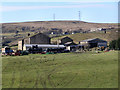
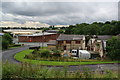
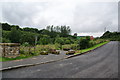
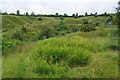
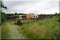
Photos of OL12 9DP


Area Information
Living in OL12 9DP offers access to a compact residential cluster defined by its specific postcode boundaries. This small area spans 20.7 hectares and supports a population of 1,571 residents. The density here is high, with 7,590 people living per square kilometre. You live within a defined postcode area that functions as a close-knit community unit rather than a sprawling suburb. Daily life revolves around this concentrated population where neighbours are likely to know one another due to the sheer number of people per unit of land. The area description classifies it as a specific postcode area covering a small residential cluster, which shapes the local rhythm and infrastructure needs. You are situated in England, part of the wider Greater Manchester region known for its industrial heritage transitioning into modern living spaces. The limited size means streets are short and distances between homes are minimal. This setup creates a distinct environment where community interaction is encouraged by physical proximity. You find yourself in a space where the built environment is dense yet contained within clear geographical limits. The area's identity is rooted in these precise measurements of land and people.
- Area Type
- Postcode
- Area Size
- 20.7 hectares
- Population
- 1571
- Population Density
- 1823 people/km²
The property market in OL12 9DP is characterised by a distinct preference for traditional housing. Houses are the standard accommodation type found throughout this postcode sector. You will find that the property stock is primarily composed of these larger residential structures rather than apartments or converted flats. Home ownership sits at 49%, indicating a balanced market where almost half of the residents are owners and the other half likely rent their homes. This split suggests a diverse buyer pool ranging from first-time buyers looking to climb the property ladder to investors seeking rental yields. The density of 7,590 people per square kilometre implies that space at a premium, potentially driving up prices for houses within this 20.7-hectare footprint. You are looking at an area where land value could be significant due to the concentration of residential units. The market reflects a community where purchasing a house is the most common path to establishing a home. Buyers should anticipate competition for these specific property types given the high population density relative to the area size. Understanding this stock helps you decide if this location fits your long-term housing goals.
House Prices in OL12 9DP
Showing 1 properties
| Address | Type | Beds | Baths | Last Sale Price | Last Sale Date | |
|---|---|---|---|---|---|---|
| Dentist, Hm Prison Buckley Hall, Buckley Farm Lane, Rochdale, OL12 9DP | commercial | - | - | - | - |
Energy Efficiency in OL12 9DP
Your lifestyle in OL12 9DP benefits from immediate access to key shopping and rail hubs within practical reach. For your grocery runs, you can visit the Tesco Rochdale or the Iceland Rochdale 2 store. The Spar near by provides essential daily necessities if you prefer smaller shop visits. This selection of retail outlets, totaling five major options, ensures you do not need to travel far for food and household goods. Public transport links are equally convenient with five rail stations offering direct access to Smither Bridge Railway Station, Rochdale Railway Station, and Littleborough Railway Station. You can also utilise the Rochdale Interchange, Rochdale Town Centre, and Newbold for broader city access. These five transport nodes streamline your daily commute significantly. Having these amenities so close means more time at home and less time in traffic. The presence of multiple railway options gives you flexibility in choosing your route. You enjoy a lifestyle where essential services are a short walk or drive away. The sheer number of nearby facilities defines the convenience of living here.
Amenities
Schools
| Rank | School | Type | Entry gender | Ages |
|---|
Explore more schools in this area
Go to Schools tabDemographics
The community in OL12 9DP reflects a mature resident base with a median age of 47 years. Most commonly, the residents fall into the Adult age range between 30 and 64 years old. This demographic profile indicates a neighbourhood dominated by families with older children or empty nesters and professionals near the peak of their careers. Home ownership stands at 49%, suggesting that nearly half of the residents own their properties outright or through a mortgage. The remaining households may be renting or living in shared arrangements typical of this age group. Houses form the predominant accommodation type, meaning the local streetscape consists mainly of detached or semi-detached dwellings rather than high-rise blocks. The area is racially diverse but predominantly White, aligning with many traditional English suburban settlements. You are dealing with a stable population where homeownership rates are roughly split between owners and non-owners. The age distribution suggests a lack of school-age children in the primary bracket, which may influence local demand for primary education versus secondary or higher education. This specific demographic mix defines the social fabric of the cluster.
Household Size
Accommodation Type
Tenure
Ethnic Group
Religion
Household Composition
Age
Household Deprivation
NS-SEC
Explore more demographic insights in this area
Go to Demographics tabPlanning
Planning Constraints
- Flood RiskPremium
- Ramsar Wetland SitesPremium
- Area of Outstanding Natural BeautyPremium
- Protected Nature ReservePremium
- Protected WoodlandPremium