Area Overview for OL12 7HL
Photos of OL12 7HL
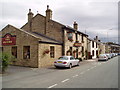
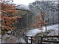
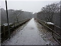
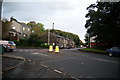
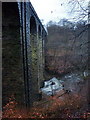
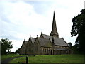

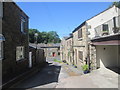
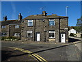
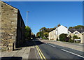
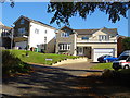
41 photos from this area
Area Information
Key information about the OL12 7HL including its size, population, and administrative classification.
- Area Type
- Postcode
- Area Size
- 2.0 hectares
- Population
- 1762
- Population Density
- 2776 people/km²
House Prices in OL12 7HL
21
Properties
£354,746
Average Sold Price
£160,000
Lowest Price
£600,000
Highest Price
Showing 21 properties
| Address | Type | Beds | Baths | Last Sale Price | Last Sale Date | |
|---|---|---|---|---|---|---|
| 331 Shawclough Road, Rochdale, OL12 7HL | house | - | - | £600,000 | Apr 2023 | |
| Beightons Stables, Shawclough Road, Rochdale, OL12 7HL | Detached | 4 | 1 | £490,000 | Aug 2022 | |
| 335 Shawclough Road, Rochdale, OL12 7HL | Detached | 4 | 2 | £385,000 | Nov 2019 | |
| 363 Shawclough Road, Rochdale, OL12 7HL | house | - | - | £273,000 | Mar 2019 | |
| 333 Shawclough Road, Rochdale, OL12 7HL | Bungalow | - | - | £399,950 | Aug 2017 | |
| South Beightons, Shawclough Road, Rochdale, OL12 7HL | Semi-detached | 7 | 3 | £390,000 | Sep 2014 | |
| Duffins Cottage, Shawclough Road, Rochdale, OL12 7HL | Detached | - | - | £410,000 | Oct 2010 | |
| 327 Shawclough Road, Rochdale, OL12 7HL | Detached | - | - | £315,000 | Apr 2010 | |
| 254 Shawclough Road, Rochdale, OL12 7HL | Detached | - | - | £279,000 | Aug 2005 | |
| 329 Shawclough Road, Rochdale, OL12 7HL | house | 4 | 4 | £265,000 | Nov 2003 |
Page 1 of 3
Energy Efficiency in OL12 7HL
Amenities
Schools
| Rank | School | Type | Entry gender | Ages |
|---|
Explore more schools in this area
Go to Schools tabDemographics
Household Size
Two person
most common
Accommodation Type
Houses
most common
Tenure
83
majority
Ethnic Group
White
most common
Religion
N/A
most common
Household Composition
N/A
most common
Age
47
median
Adults (30-64 years)
most common
Household Deprivation
N/A
with no deprivation
NS-SEC
43
in Lower managerial occupations
Explore more demographic insights in this area
Go to Demographics tabPlanning
Planning Constraints
- Flood RiskPremium
- Ramsar Wetland SitesPremium
- Area of Outstanding Natural BeautyPremium
- Protected Nature ReservePremium
- Protected WoodlandPremium