Area Overview for OL12 7FE
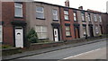
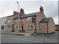
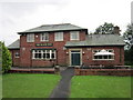
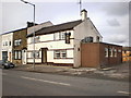
Photos of OL12 7FE
Area Information
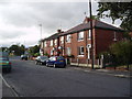
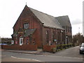
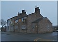
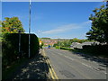
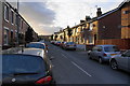
OL12 7FE represents a specific residential cluster within the village of Norden, located in the Metropolitan Borough of Rochdale, Greater Manchester. Historically part of Lancashire until the 1974 local government reorganisation, Norden sits on the western outskirts of Rochdale along the A680 Edenfield Road. This postcode covers a small population of 1,507 residents, creating a community where neighbours likely know one another. The area lacks major planning constraints such as protected woodlands, Ramsar wetland sites, or Areas of Outstanding Natural Beauty, meaning development is not held back by strict environmental designations. Residents live alongside the Grade II listed St Paul's Church, which was constructed between 1860 and 1861. Living in OL12 7FE means being situated in a historic chapelry that originated in the mid-19th century from part of Spotland township. Daily life revolves around the A680, which connects Rochdale to Edenfield in Rossendale. While specific journey times are not detailed, the primary thoroughfare provides the main route for commuting. The area is defined by its small scale relative to Rochdale, with a population density of 461 people per square kilometre. You are buying into a location with deep roots in the local history, standing as part of the original ecclesiastical parish created in 1862. The immediate surroundings reflect a blend of long-standing residential history and modern connectivity requirements.
- Area Type
- Postcode
- Area Size
- Not available
- Population
- 1507
- Population Density
- 461 people/km²
The housing market in OL12 7FE is characterised by a dominant owner-occupied sector, where 90% of residents hold their properties free of leasehold obligations. This high ownership rate indicates that the neighbourhood is established rather than in flux, appealing to buyers seeking continuity and local investment. Accommodation types are exclusively houses, offering traditional layouts and extensive garden space compared to flats or apartments found in urban Rochdale centres. You can expect to find properties suited to families, given the alignment between the house stock and the median age of 47. The absence of rental data in the primary description reinforces that transactions are driven by purchase rather than tenancy rights. For you, the buyer, this means less competition from institutional landlords or high-turnover tenants who often dominate urban property searches. The 1,507 population spread across the postcode suggests a limited inventory, which may strengthen demand among successful local buyers. Property values here likely reflect the desire for house ownership in a climate where northern England sees rising demand for semi-rural living. The focus on houses implies that each purchase involves a significant investment in a standalone dwelling rather than a shared structure. Your potential purchases will represent a stake in a community where neighbours have likely lived in the same homes for decades. This stability creates a unique market dynamic where price is influenced by long-term local sentiment and household wealth.
House Prices in OL12 7FE
No properties found in this postcode.
Energy Efficiency in OL12 7FE
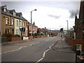
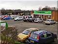
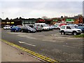
Residents of OL12 7FE enjoy access to a diverse range of amenities located in Rochdale town centre and surrounding villages. Supermarkets such as Tesco Rochdale, Co-op Rochdale, and Co-op Rooley are within practical reach, ensuring daily shopping needs are met without extensive travel. The retail offer extends to five distinct locations, providing a solid selection of grocers, pharmacies, and daily essentials. Transport links are equally accessible, with five metro connections available at Rochdale Town Centre, Rochdale Interchange, and Newbold. You can also utilise five railway stations, including Rochdale Railway Station, Castleton Railway Station, and Smithy Bridge Railway Station, to access the wider national network. These rail links facilitate easy commuting to Manchester, Leeds, and other key employment hubs. The village character is reinforced by landmarks like St Paul's Church, which adds visual interest and historical context to the suburban walk. Daily life here balances village convenience with the ability to reach substantial town centres quickly. You have the freedom to retreat home after a week in the city while maintaining a short drive to quality retail and leisure options. The integration of the A680 corridor means that while you are in a village setting, the town of Rochdale feels close enough for weekly trips but far enough for a quiet residential backdrop.
Amenities
Schools
The educational landscape immediately surrounding OL12 7FE centres on a single provision, reflecting the scale of the vicinity. Willow View School is the notable institution serving the area, operating as a special school with a good quality rating from Ofsted. This designation confirms a standard of educational provision that meets regulatory excellence despite the specialised nature of its curriculum. Families in this postcode will rely primarily on this facility for their children's needs, given the absence of other listed schools in the immediate proximity. The concentration of one special school suggests that general comprehensive primary or secondary education may require travel to other wards within Rochdale, such as towards Edenfield or the main town centre. When considering schools near OL12 7FE, you must account for the specific needs of students who require special educational support or those with additional requirements. The position of Willow View as a 'good' rated establishment is a key data point for parents researching local options. It is essential for you to verify if your child falls under the special educational needs remit that this school caters to, as the general school catchment may differ significantly from the special education provision. The data does not list mainstream primary schools within a practical walking distance from this postcode.
| Rank | School | Type | Entry gender | Ages |
|---|
Explore more schools in this area
Go to Schools tabDemographics
The community within OL12 7FE is predominantly composed of adults aged between 30 and 64 years, reflecting a settled demographic. The median age for residents is 47, indicating that families and older professionals make up the core of this neighbourhood. Home ownership is exceptionally high, with 90% of the population owning their homes. This figure confirms that the area is defined by long-term residents rather than a transient rental market. The accommodation type consists primarily of houses, which aligns with the high rate of ownership and the family-focused age profile. Predominantly, the local population identifies as White. This data paints a picture of a stable, established community where property is likely viewed through multi-generational wealth. The 1,507 total population over a small footprint contributes to a density of 461 people per square kilometre. Such figures suggest a quiet environment where residents enjoy a sense of place without the congestion found in denser urban centres. You will find that the majority of your neighbours are homeowners, likely with significant local knowledge and investment in the community infrastructure. The absence of young children under ten or elderly residents over 75 in the primary data suggests a mid-life demographic focus. This profile supports a lifestyle centred on stability rather than transient living arrangements.
Household Size
Accommodation Type
Tenure
Ethnic Group
Religion
Household Composition
Age
Household Deprivation
NS-SEC
Explore more demographic insights in this area
Go to Demographics tabPlanning
Planning Constraints
- Flood RiskPremium
- Ramsar Wetland SitesPremium
- Area of Outstanding Natural BeautyPremium
- Protected Nature ReservePremium
- Protected WoodlandPremium