Area Overview for OL12 0TF
Photos of OL12 0TF
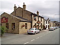
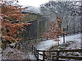
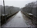
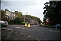
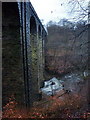
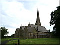

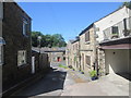
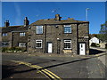
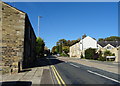
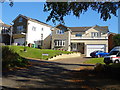
41 photos from this area
Area Information
Key information about the OL12 0TF including its size, population, and administrative classification.
- Area Type
- Postcode
- Area Size
- 1.3 hectares
- Population
- 1436
- Population Density
- 2837 people/km²
House Prices in OL12 0TF
20
Properties
£106,284
Average Sold Price
£48,500
Lowest Price
£152,000
Highest Price
Showing 20 properties
| Address | Type | Beds | Baths | Last Sale Price | Last Sale Date | |
|---|---|---|---|---|---|---|
| 695 Whitworth Road, Rochdale, OL12 0TF | Semi-detached | 3 | 88 | £150,000 | May 2021 | |
| 2, Healey Cottages, Whitworth Road, Rochdale, OL12 0TF | Cottage | 3 | 1 | £146,050 | Jun 2020 | |
| 685 Whitworth Road, Rochdale, OL12 0TF | Semi-detached | 3 | 2 | £150,000 | Sep 2019 | |
| 725 Whitworth Road, Rochdale, OL12 0TF | Semi-detached | 3 | 1 | £140,000 | Jul 2019 | |
| 701 Whitworth Road, Rochdale, OL12 0TF | Semi-detached | 2 | 1 | £98,000 | Apr 2019 | |
| 713 Whitworth Road, Rochdale, OL12 0TF | Semi-detached | 3 | 1 | £139,000 | Jan 2019 | |
| 687 Whitworth Road, Rochdale, OL12 0TF | Semi-detached | - | - | £90,000 | Aug 2017 | |
| 699 Whitworth Road, Rochdale, OL12 0TF | house | - | - | £152,000 | Aug 2014 | |
| 717 Whitworth Road, Rochdale, OL12 0TF | house | 3 | - | £135,000 | Dec 2013 | |
| 689 Whitworth Road, Rochdale, OL12 0TF | Semi-detached | 3 | 1 | £125,000 | Dec 2004 |
Page 1 of 2
Energy Efficiency in OL12 0TF
Amenities
Schools
| Rank | School | Type | Entry gender | Ages |
|---|
Explore more schools in this area
Go to Schools tabDemographics
Household Size
One person
most common
Accommodation Type
Houses
most common
Tenure
65
majority
Ethnic Group
White
most common
Religion
N/A
most common
Household Composition
N/A
most common
Age
47
median
Adults (30-64 years)
most common
Household Deprivation
N/A
with no deprivation
NS-SEC
29
in Lower managerial occupations
Explore more demographic insights in this area
Go to Demographics tabPlanning
Planning Constraints
- Flood RiskPremium
- Ramsar Wetland SitesPremium
- Area of Outstanding Natural BeautyPremium
- Protected Nature ReservePremium
- Protected WoodlandPremium