Area Overview for OL12 0QQ
Photos of OL12 0QQ
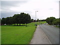
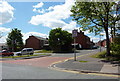
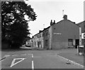
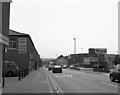


Area Information
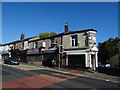
Living in OL12 0QQ means residing within a specific postcode area that covers a small residential cluster in England. This location spans 1,284 square metres and houses a population of 1,701 residents. The community is defined by its compact nature, where daily life revolves close to home for most neighbours. You will find a predominantly housing-led environment rather than a high-density urban setting. With 132,491,4 people per square kilometre recorded in the dataset, the area presents a concentrated residential zone. This density suggests limited open space but potentially closer neighbourly interactions within the cluster. The area serves as a distinct pocket within the wider Rochdale region. Prospective buyers探访 this postcode should understand they are entering a contained community where services are accessed via immediate proximity rather than vast infrastructure. The small footprint means that walking distances to nearby hubs are the primary mode of local travel. This setting offers a quiet residential experience, though the specific character of the streets remains tied to the surrounding town centre institutions. Understanding the scale of this postcode is essential for anyone considering homes in OL12 0QQ.
- Area Type
- Postcode
- Area Size
- 1284 m²
- Population
- 1701
- Population Density
- 10143 people/km²
The property market in OL12 0QQ is characterised by a specific mix of home ownership and rental arrangements. With 42 per cent of residents owning their homes, this area presents itself as an established residential zone rather than a purely speculative investment market. The accommodation type data confirms that houses are the dominant housing stock. This predominance of detached or semi-detached properties aligns with the median age of 47, which often correlates with families seeking space and stability. Buyers looking at homes in OL12 0QQ should expect to interact primarily with owner-occupied sellers or long-term tenants. The small total population of 1,701 limits the total inventory available for purchase compared to larger urban districts. This scarcity can influence price dynamics and buyer competition. The fact that houses are the standard accommodation type means you will likely encounter properties suited to families or individuais seeking privacy over high-rise living. Understanding that over half the population rents while the minority owns helps contextualise the turnover rate and the nature of neighbourhood change. Whether you aim to buy or rent in this postcode, the market structure reflects a stable, house-centric environment typical of suburban clusters near Rochdale.
House Prices in OL12 0QQ
Showing 3 properties
| Address | Type | Beds | Baths | Last Sale Price | Last Sale Date | |
|---|---|---|---|---|---|---|
| 21 Industry Road, Rochdale, OL12 0QQ | Semi-detached | 3 | 1 | £71,500 | May 2024 | |
| 23 Industry Road, Rochdale, OL12 0QQ | house | 3 | - | £62,000 | Nov 2010 | |
| 29 Industry Road, Rochdale, OL12 0QQ | house | - | - | - | - |
Energy Efficiency in OL12 0QQ
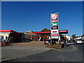
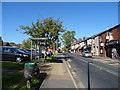
Residents of OL12 0QQ enjoy access to a range of amenities within practical walking or short driving distance. Retail convenience is supported by five nearby stores, including Iceland Rochdale 2, Lidl Central, and Farmfoods Rochdale. These supermarkets provide essential groceries and household goods without requiring a journey deep into the city centre. Transport connectivity is heavily reinforced by metro and rail options. Five metro facilities are accessible, including Rochdale Town Centre, Rochdale Interchange, and Newbold. Additionally, five railway stations serve the broader area, such as Rochdale Railway Station, Smithy Bridge Railway Station, and Castleton Railway Station. This dense network of transport nodes allows for efficient travel to wider regions. For shoppers, the presence of Iceland and Lidl ensures that daily essentials are just minutes away. Commuters benefit from multiple rail links that connect the residential cluster to national destinations. The blend of retail and transport hubs creates a convenient lifestyle where daily tasks require minimal travel time. You do not need a car for basic shopping or local travel, as the five nearby shops and five metro points cover most immediate needs.
Amenities
Schools
Families considering schools near OL12 0QQ will find limited local options within the immediate vicinity of this postcode. The only educational institution with a confirmed listing for this area is Howard Street Nursery School. This facility serves as a nursery, catering specifically to the earliest years of childhood education. The absence of primary, secondary, or further education establishments directly named for OL12 0QQ means that older children and teenagers must rely on schools located in the proximity of Rochdale or other neighbouring towns. Residents with young families will benefit from the presence of a nursery, providing early years support close to their homes. However, parents needing places for primary or secondary education will need to investigate transportation options to larger educational hubs outside this small cluster. The reliance on external schools is a standard feature of many residential postcodes where local planning concentrates larger institutions in town centres. Howard Street Nursery School stands as the sole confirmed educational asset within the data for this location, highlighting the need for families to plan commuting routes for older siblings.
| Rank | School | Type | Entry gender | Ages |
|---|
Explore more schools in this area
Go to Schools tabDemographics
The community in OL12 0QQ reflects a mature population profile with a median age of 47 years. Most residents fall into the adult age range of 30 to 64 years, indicating a household base that values stability and established neighbourhoods. Housing tenure shows that 42% of residents own their homes, suggesting a significant portion of the population has achieved financial security through property purchase. The remaining residents likely rely on the rental market or live with family members given the area's small size. Houses form the predominant accommodation type across this postcode, aligning with the preferences of the median age demographic. Ethnic diversity is evident, with the Asian total group being the predominant ethnic category within this specific cluster. This demographic makeup contributes to the cultural fabric of the local area. The resident age profile suggests a neighbourhood where schools and family-focused amenities are relevant, even if childcare facilities are limited. You will find a community where long-term residents form the core of social interactions. This demographic stability influences local demand and the types of services that thrive in immediate reach of OL12 0QQ.
Household Size
Accommodation Type
Tenure
Ethnic Group
Religion
Household Composition
Age
Household Deprivation
NS-SEC
Explore more demographic insights in this area
Go to Demographics tabPlanning
Planning Constraints
- Flood RiskPremium
- Ramsar Wetland SitesPremium
- Area of Outstanding Natural BeautyPremium
- Protected Nature ReservePremium
- Protected WoodlandPremium