Area Overview for OL12 0EG
Photos of OL12 0EG
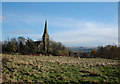
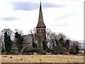
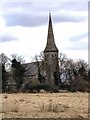
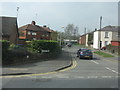
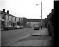
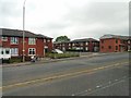
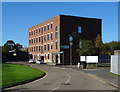
44 photos from this area
Area Information
Key information about the OL12 0EG including its size, population, and administrative classification.
- Area Type
- Postcode
- Area Size
- 1.1 hectares
- Population
- 1647
- Population Density
- 3933 people/km²
House Prices in OL12 0EG
29
Properties
£115,391
Average Sold Price
£7,384
Lowest Price
£195,000
Highest Price
Showing 29 properties
| Address | Type | Beds | Baths | Last Sale Price | Last Sale Date | |
|---|---|---|---|---|---|---|
| 21 Rossall Road, Rochdale, OL12 0EG | Semi-detached | 4 | 1 | £195,000 | Sep 2024 | |
| 29 Rossall Road, Rochdale, OL12 0EG | Semi-detached | 2 | 1 | £150,000 | Jul 2023 | |
| 37 Rossall Road, Rochdale, OL12 0EG | house | - | - | £165,000 | Jul 2023 | |
| 10 Rossall Road, Rochdale, OL12 0EG | Semi-detached | 2 | 1 | £70,000 | May 2023 | |
| 23 Rossall Road, Rochdale, OL12 0EG | Detached | 3 | 1 | £155,000 | Jan 2023 | |
| 12 Rossall Road, Rochdale, OL12 0EG | house | - | - | £145,000 | Jul 2022 | |
| 37A Rossall Road, Rochdale, OL12 0EG | house | - | - | £100,000 | Mar 2021 | |
| 13 Rossall Road, Rochdale, OL12 0EG | Detached | 4 | 2 | £165,000 | Feb 2021 | |
| 7 Rossall Road, Rochdale, OL12 0EG | Terraced | 3 | 2 | £125,000 | May 2017 | |
| 1 Rossall Road, Rochdale, OL12 0EG | Terraced | 3 | 3 | £123,500 | May 2017 |
Page 1 of 3
Energy Efficiency in OL12 0EG
Amenities
Schools
| Rank | School | Type | Entry gender | Ages |
|---|
Explore more schools in this area
Go to Schools tabDemographics
Household Size
Family (3-5 people)
most common
Accommodation Type
Houses
most common
Tenure
57
majority
Ethnic Group
asian_total
most common
Religion
N/A
most common
Household Composition
N/A
most common
Age
47
median
Adults (30-64 years)
most common
Household Deprivation
N/A
with no deprivation
NS-SEC
17
in Lower managerial occupations
Explore more demographic insights in this area
Go to Demographics tabPlanning
Planning Constraints
- Flood RiskPremium
- Ramsar Wetland SitesPremium
- Area of Outstanding Natural BeautyPremium
- Protected Nature ReservePremium
- Protected WoodlandPremium