Area Overview for OL11 5SE
Photos of OL11 5SE
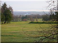
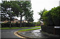
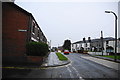
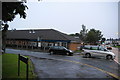
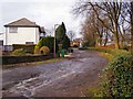
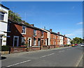
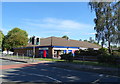
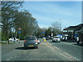
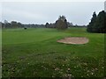
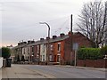
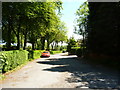
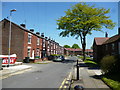
18 photos from this area
Area Information
Key information about the OL11 5SE including its size, population, and administrative classification.
- Area Type
- Postcode
- Area Size
- 2.6 hectares
- Population
- 1728
- Population Density
- 1729 people/km²
House Prices in OL11 5SE
22
Properties
£406,321
Average Sold Price
£165,000
Lowest Price
£660,000
Highest Price
Showing 22 properties
| Address | Type | Beds | Baths | Last Sale Price | Last Sale Date | |
|---|---|---|---|---|---|---|
| 7A Spring Bank Lane, Rochdale, OL11 5SE | house | - | - | £530,000 | Dec 2022 | |
| The Hollies, 13A Spring Bank Lane, Rochdale, OL11 5SE | Detached | 3 | 2 | £165,000 | Sep 2021 | |
| 33 Spring Bank Lane, Rochdale, OL11 5SE | Bungalow | 4 | 2 | £490,000 | Jun 2021 | |
| The Folly, Spring Bank Lane, Rochdale, OL11 5SE | house | 8 | 3 | £390,000 | Nov 2019 | |
| 5 Spring Bank Lane, Rochdale, OL11 5SE | Detached | 5 | 3 | £565,000 | May 2019 | |
| 21 Spring Bank Lane, Rochdale, OL11 5SE | Terraced | 2 | 1 | £193,500 | Sep 2018 | |
| 11 Spring Bank Lane, Rochdale, OL11 5SE | Detached | 6 | 3 | £572,500 | Feb 2017 | |
| Brooklands, Spring Bank Lane, Rochdale, OL11 5SE | Bungalow | - | - | £570,000 | Oct 2015 | |
| 3A Spring Bank Lane, Rochdale, OL11 5SE | Bungalow | 3 | 2 | £370,000 | Nov 2012 | |
| 27 Spring Bank Lane, Rochdale, OL11 5SE | house | - | - | £660,000 | Jun 2011 |
Page 1 of 3
Energy Efficiency in OL11 5SE
Amenities
Schools
| Rank | School | Type | Entry gender | Ages |
|---|
Explore more schools in this area
Go to Schools tabDemographics
Household Size
Two person
most common
Accommodation Type
Houses
most common
Tenure
83
majority
Ethnic Group
White
most common
Religion
N/A
most common
Household Composition
N/A
most common
Age
47
median
Adults (30-64 years)
most common
Household Deprivation
N/A
with no deprivation
NS-SEC
44
in Lower managerial occupations
Explore more demographic insights in this area
Go to Demographics tabPlanning
Planning Constraints
- Flood RiskPremium
- Ramsar Wetland SitesPremium
- Area of Outstanding Natural BeautyPremium
- Protected Nature ReservePremium
- Protected WoodlandPremium