Area Overview for OL11 2YQ
Photos of OL11 2YQ
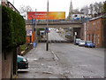
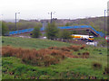
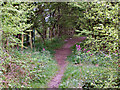
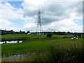
50 photos from this area
Area Information
Key information about the OL11 2YQ including its size, population, and administrative classification.
- Area Type
- Postcode
- Area Size
- 1.6 hectares
- Population
- 1976
- Population Density
- 1452 people/km²
House Prices in OL11 2YQ
46
Properties
£89,354
Average Sold Price
£46,000
Lowest Price
£173,000
Highest Price
Showing 46 properties
| Address | Type | Beds | Baths | Last Sale Price | Last Sale Date | |
|---|---|---|---|---|---|---|
| 10 Croydon Avenue, Rochdale, OL11 2YQ | Semi-detached | 3 | 2 | £95,000 | Mar 2025 | |
| 14 Croydon Avenue, Rochdale, OL11 2YQ | Semi-detached | 3 | 1 | £170,000 | May 2023 | |
| 20 Croydon Avenue, Rochdale, OL11 2YQ | Semi-detached | 3 | 1 | £173,000 | Apr 2023 | |
| 7 Croydon Avenue, Rochdale, OL11 2YQ | Semi-detached | - | - | £66,000 | Nov 2022 | |
| 46 Croydon Avenue, Rochdale, OL11 2YQ | house | 3 | - | £98,000 | Nov 2020 | |
| 27 Croydon Avenue, Rochdale, OL11 2YQ | Semi-detached | - | - | £87,000 | Apr 2018 | |
| 4 Croydon Avenue, Rochdale, OL11 2YQ | house | - | - | £95,000 | May 2017 | |
| 44 Croydon Avenue, Rochdale, OL11 2YQ | Semi-detached | - | - | £86,000 | Sep 2010 | |
| 9 Croydon Avenue, Rochdale, OL11 2YQ | Semi-detached | 3 | 1 | £50,000 | Feb 2007 | |
| 3 Croydon Avenue, Rochdale, OL11 2YQ | Semi-detached | - | - | £79,000 | Oct 2006 |
Page 1 of 5
Energy Efficiency in OL11 2YQ
Amenities
Schools
| Rank | School | Type | Entry gender | Ages |
|---|
Explore more schools in this area
Go to Schools tabDemographics
Household Size
Family (3-5 people)
most common
Accommodation Type
Houses
most common
Tenure
72
majority
Ethnic Group
White
most common
Religion
N/A
most common
Household Composition
N/A
most common
Age
47
median
Adults (30-64 years)
most common
Household Deprivation
N/A
with no deprivation
NS-SEC
29
in Lower managerial occupations
Explore more demographic insights in this area
Go to Demographics tabPlanning
Planning Constraints
- Flood RiskPremium
- Ramsar Wetland SitesPremium
- Area of Outstanding Natural BeautyPremium
- Protected Nature ReservePremium
- Protected WoodlandPremium