Area Overview for OL11 2SB
Photos of OL11 2SB
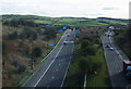
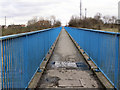
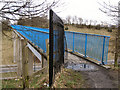
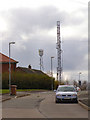
36 photos from this area
Area Information
Key information about the OL11 2SB including its size, population, and administrative classification.
- Area Type
- Postcode
- Area Size
- 1.3 hectares
- Population
- 2484
- Population Density
- 4170 people/km²
House Prices in OL11 2SB
40
Properties
£109,069
Average Sold Price
£71,000
Lowest Price
£182,995
Highest Price
Showing 40 properties
| Address | Type | Beds | Baths | Last Sale Price | Last Sale Date | |
|---|---|---|---|---|---|---|
| 170 Hill Top Drive, Rochdale, OL11 2SB | house | - | - | £72,000 | Jun 2021 | |
| 168 Hill Top Drive, Rochdale, OL11 2SB | house | - | - | £95,000 | Mar 2021 | |
| 167 Hill Top Drive, Rochdale, OL11 2SB | house | - | - | £106,995 | Nov 2020 | |
| 165 Hill Top Drive, Rochdale, OL11 2SB | house | - | - | £99,995 | Oct 2020 | |
| 147 Hill Top Drive, Rochdale, OL11 2SB | house | - | - | £89,000 | Oct 2020 | |
| 163 Hill Top Drive, Rochdale, OL11 2SB | house | - | - | £106,995 | Sep 2020 | |
| 161 Hill Top Drive, Rochdale, OL11 2SB | house | - | - | £100,995 | Sep 2020 | |
| 155 Hill Top Drive, Rochdale, OL11 2SB | house | - | - | £182,995 | Sep 2020 | |
| 157 Hill Top Drive, Rochdale, OL11 2SB | house | - | - | £131,995 | Sep 2020 | |
| 159 Hill Top Drive, Rochdale, OL11 2SB | house | - | - | £119,995 | Sep 2020 |
Page 1 of 4
Energy Efficiency in OL11 2SB
Amenities
Schools
| Rank | School | Type | Entry gender | Ages |
|---|
Explore more schools in this area
Go to Schools tabDemographics
Household Size
Family (3-5 people)
most common
Accommodation Type
Houses
most common
Tenure
26
majority
Ethnic Group
White
most common
Religion
N/A
most common
Household Composition
N/A
most common
Age
47
median
Adults (30-64 years)
most common
Household Deprivation
N/A
with no deprivation
NS-SEC
11
in Lower managerial occupations
Explore more demographic insights in this area
Go to Demographics tabPlanning
Planning Constraints
- Flood RiskPremium
- Ramsar Wetland SitesPremium
- Area of Outstanding Natural BeautyPremium
- Protected Nature ReservePremium
- Protected WoodlandPremium