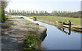
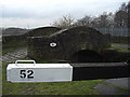
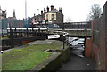
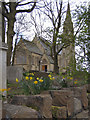
Area Overview for OL11 2PP
Photos of OL11 2PP
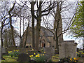
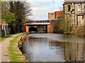
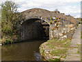
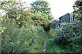
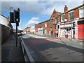


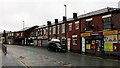
99 photos from this area
Area Information
Key information about the OL11 2PP including its size, population, and administrative classification.
- Area Type
- Postcode
- Area Size
- 3.7 hectares
- Population
- 1588
- Population Density
- 867 people/km²
House Prices in OL11 2PP
62
Properties
£91,296
Average Sold Price
£28,950
Lowest Price
£180,000
Highest Price
Showing 62 properties
| Address | Type | Beds | Baths | Last Sale Price | Last Sale Date | |
|---|---|---|---|---|---|---|
| 21 Alder Road, Rochdale, OL11 2PP | house | - | - | £86,000 | Jul 2025 | |
| 43 Alder Road, Rochdale, OL11 2PP | Semi-detached | 2 | 1 | £145,000 | Jul 2024 | |
| 45 Alder Road, Rochdale, OL11 2PP | Terraced | 3 | 1 | £180,000 | May 2023 | |
| 38 Alder Road, Rochdale, OL11 2PP | house | 2 | 1 | £142,000 | Dec 2022 | |
| 14 Alder Road, Rochdale, OL11 2PP | house | - | - | £120,000 | Feb 2022 | |
| 61 Alder Road, Rochdale, OL11 2PP | Semi-detached | 3 | 1 | £125,000 | Dec 2021 | |
| 10 Alder Road, Rochdale, OL11 2PP | house | - | - | £128,750 | Oct 2021 | |
| 12 Alder Road, Rochdale, OL11 2PP | house | - | - | £133,000 | Jul 2021 | |
| 34 Alder Road, Rochdale, OL11 2PP | Semi-detached | 3 | 1 | £90,000 | Jul 2021 | |
| 19 Alder Road, Rochdale, OL11 2PP | house | - | - | £94,000 | Feb 2021 |
Page 1 of 7
Energy Efficiency in OL11 2PP
Amenities
Schools
| Rank | School | Type | Entry gender | Ages |
|---|
Explore more schools in this area
Go to Schools tabDemographics
Household Size
Family (3-5 people)
most common
Accommodation Type
Houses
most common
Tenure
69
majority
Ethnic Group
White
most common
Religion
N/A
most common
Household Composition
N/A
most common
Age
47
median
Adults (30-64 years)
most common
Household Deprivation
N/A
with no deprivation
NS-SEC
25
in Lower managerial occupations
Explore more demographic insights in this area
Go to Demographics tabPlanning
Planning Constraints
- Flood RiskPremium
- Ramsar Wetland SitesPremium
- Area of Outstanding Natural BeautyPremium
- Protected Nature ReservePremium
- Protected WoodlandPremium