Area Overview for OL10 4UB
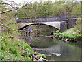
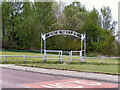
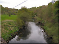
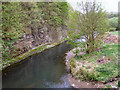
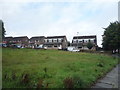
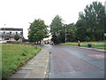
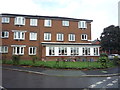
Photos of OL10 4UB


Area Information
Living in OL10 4UB means settling into a specific residential cluster characterised by low population density. This small postcode area accommodates just 1,512 people across a landscape where there are only 77 people per square kilometre. You will find a community that is less crowded than many urban centres, offering a quiet domestic setting within Greater Manchester. The area sits entirely in England and functions as a contained neighbourhood rather than a sprawling district. Daily life here revolves around the convenience of nearby towns while appreciating the spaciousness of a low-density environment. Residents enjoy a suburban pace where homes are not packed tightly together. This setting suits those who value privacy without wishing to commit to remote rural isolation. The compact nature of the postcode allows for easy access to essential services while maintaining a distinct identity from larger surrounding towns. You purchase a slice of life defined by its manageable scale and stable character.
- Area Type
- Postcode
- Area Size
- Not available
- Population
- 1512
- Population Density
- 77 people/km²
The property market in OL10 4UB is predominantly shaped by owner occupation rather than the rental sector. With 68 per cent of homes owned by their residents, the area functions as a settled market where properties tend to be sold to people entering or expanding their own households. Houses form the primary accommodation type, defining the visual character and architectural style of the neighbourhood. This concentration of detached or semi-detached properties creates a uniform streetscape typical of older residential developments in Greater Manchester. Buyers looking for specific leasehold apartments or new-build conversions may find limited immediate stock within these precise boundaries. However, the surrounding clusters likely mirror this domestic focus, offering similar housing stock to potential purchasers. The high ownership rate implies that prices are driven by investor demand for holiday homes or capital retention rather than rapid renter turnover. Prospective buyers should expect a market with fewer price fluctuations than high-rental-density areas. Understanding this stock composition helps in assessing maintenance costs and resale value trajectory.
House Prices in OL10 4UB
No properties found in this postcode.
Energy Efficiency in OL10 4UB
Residents of OL10 4UB enjoy practical access to essential retail and transport hubs in nearby Heywood and Bury. Retail options include three major supermarkets within reach: Morrisons Heywood, Iceland Heywood, and Tesco Heywood. These venues provide a comprehensive range of groceries and household essentials without requiring a long journey. Transport links are equally well developed, featuring five metro stops and five railway stations within a practical radius. Key rail connections include Castleton Railway Station, Rochdale Railway Station, and Mills Hill Railway Station, offering flexible travel plans across Greater Manchester. The Bury Interchange serves as a major hub for connecting to wider travel networks. This combination of named amenities means daily shopping and commuting take on a convenient local character. You can stock up on essentials or travel to the city centre without excessive planning. The presence of these specific business names confirms a mature network of services tailored to family needs.
Amenities
Schools
Families residing near OL10 4UB have direct access to highly rated educational facilities within a short commute. St Michael's Church of England Primary School in Bamford stands out as the key nearby institution. This school holds an outstanding Ofsted rating, a designation that requires sustained excellence in teaching and pupil outcomes. Its presence offers families reassurance regarding the quality of early education available to local children. While secondary options are not listed for this specific postcode, the proximity to a primary school with the highest possible rating is a significant advantage for households with younger children. The school's status suggests a competitive environment and high standards of governance. Living in OL10 4UB provides convenient access to these educational resources, reducing daily travel times for school runs. This educational anchor contributes to the area's appeal for parents prioritising academic performance and school stability.
| Rank | School | Type | Entry gender | Ages |
|---|
Explore more schools in this area
Go to Schools tabDemographics
The community within OL10 4UB is defined by a mature demographic profile with a median age of 47 years. Adults between 30 and 64 years old represent the most common age range, confirming that this is an area established by long-term residents rather than young professionals or students. Home ownership is high, standing at 68 per cent, which indicates a stable population with deep roots in the locality. The vast majority of the stock consists of houses, reflecting a preference for traditional single-family dwellings over flats or other accommodation types. White residents form the predominant ethnic group, aligning with the broader demographic trends of many established Manchester suburbs. This profile suggests a neighbourhood where families with grown children or empty nesters have settled for the long term. The high rate of ownership often correlates with greater investment in property maintenance and community stability. Living here offers a sense of permanence that appeals to buyers seeking a classic family home environment.
Household Size
Accommodation Type
Tenure
Ethnic Group
Religion
Household Composition
Age
Household Deprivation
NS-SEC
Explore more demographic insights in this area
Go to Demographics tabPlanning
Planning Constraints
- Flood RiskPremium
- Ramsar Wetland SitesPremium
- Area of Outstanding Natural BeautyPremium
- Protected Nature ReservePremium
- Protected WoodlandPremium