Area Overview for OL10 4PU
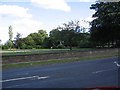
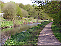
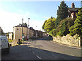
Photos of OL10 4PU


Area Information
OL10 4PU represents a specific residential cluster within Greater Manchester, covering an area of just 1.3 hectares. This compact footprint supports a population of 1,783 residents, creating a defined neighbourhood with a high density of 139,639 people per square kilometre. Living in OL10 4PU means navigating a tightly knit environment where proximity is a defining feature of daily life. The postcode area functions as a distinct pocket within the wider Heywood community, offering a mix of semi-rural character and accessible urban connectivity. Residents of this small area benefit from immediate access to major transport hubs while remaining within a contained residential setting. The site description confirms this is a small cluster rather than a sprawling district, which influences the pace and noise level of everyday life. Prospective homebuyers should note that the area is specifically classified as a postcode zone in the OL10 region of England. The combination of precise boundaries and high population density suggests a location that serves as a practical base for commuting to nearby towns like Bury and Rochdale. Understanding the exact size of OL10 4PU helps buyers visualise the boundary lines and the extent of their immediate neighbourhood.
- Area Type
- Postcode
- Area Size
- 1.3 hectares
- Population
- 1783
- Population Density
- 3029 people/km²
Homes in OL10 4PU are predominantly houses, which sets this area apart from districts with high concentrations of flats or bungalows. The property market in this postcode reflects a 25% home ownership rate, a statistic that suggests a significant portion of the housing stock is occupied by tenants rather than landlords or owner-occupiers. This specific ratio of rented to owned properties shapes the character of the local estate agents and lettings market. Buyers looking at OL10 4PU must navigate a landscape where rental transactions may be as common as sales, potentially affecting local regulations and building standards. The accommodation type data confirms that traditional housing forms, specifically houses, are the core asset class in this 1.3 hectare zone. A low ownership rate of one-quarter often correlates with areas near industrial estates or student corridors, though the house statistic here points towards family rentals. Prospective buyers should be prepared for a market where leasehold or social housing might be prevalent alongside private sector homes. The density of 139,639 people per square kilometre indicates that land use is intensive, potentially limiting future expansion of new builds within the strict boundaries of OL10 4PU.
House Prices in OL10 4PU
Showing 5 properties
| Address | Type | Beds | Baths | Last Sale Price | Last Sale Date | |
|---|---|---|---|---|---|---|
| Petrol Filling Station, Wm Morrison Supermarkets Plc, Dawson Street, Heywood, OL10 4PU | retail_financial | - | - | - | - | |
| Car Wash, Wm Morrison Supermarkets Plc, Dawson Street, Heywood, OL10 4PU | Industrial | - | - | - | - | |
| Grey Dropboxes, Wm Morrison Supermarkets Plc, Dawson Street, Heywood, OL10 4PU | Retail | - | - | - | - | |
| Blue Drop Boxes, Wm Morrison Supermarkets Plc, Dawson Street, Heywood, OL10 4PU | Retail | - | - | - | - | |
| Inpost Parcel Locker Ukhey18911, Wm Morrison Supermarkets Plc, Dawson Street, Heywood, OL10 4PU | Retail | - | - | - | - |
Energy Efficiency in OL10 4PU
Residents of OL10 4PU enjoy immediate access to a range of retail and transport options within practical reach. Five major retail venues operate nearby, including Morrisons Heywood, Iceland Heywood, and Tesco Heywood York, ensuring grocery and household needs are easily met. Transport links are strong, with five metro services connecting the area to Heywood, Bury Interchange, and Bury, facilitating easy travel across Greater Manchester. Five rail services provide access to Castleton Railway Station, Rochdale Railway Station, and Mills Hill Railway Station, offering further connectivity to Oldham and beyond. This array of amenities means daily errands do not require long car journeys, as shops and train stations are situated close enough for short trips. The concentration of retail outlets like Iceland and Tesco indicates a mature high street network serving the local cluster. Commuters benefit from multiple railway options, allowing them to compare schedules and ticket prices for journeys to Manchester or Rochdale. The variety of transport and retail choices supports a self-sufficient lifestyle where residents can buy food or catch a train without leaving the borough.
Amenities
Schools
Families considering OL10 4PU have access to specific educational institutions within the immediate vicinity. Moss Field Community School serves as the primary school option for the area, offering education for younger children in the local community. For pupils with special educational needs and disabilities, Birtle View School provides dedicated support and provision as a special school near OL10 4PU. The presence of both a primary institution and a special needs school indicates that the area caters to diverse educational requirements without relying solely on a secondary site. Parents living in this postcode must plan their routes carefully, as the distance to secondary schools is not detailed in the current local data. The mix of school types suggests a neighbourhood that is conscious of inclusive education alongside standard primary schooling. When choosing OL10 4PU as a home base, residents need to verify which feeder zones apply to Moss Field Community School for their specific address. The availability of Birtle View School confirms that local infrastructure supports children with specific learning and physical requirements, adding a layer of community care to the educational landscape.
| Rank | School | Type | Entry gender | Ages |
|---|
Explore more schools in this area
Go to Schools tabDemographics
The community profile for OL10 4PU reveals a mature population with a median age of 47 years. Adults between 30 and 64 years old constitute the most common age range, indicating a neighbourhood dominated by established families or empty nesters rather than young professionals. Home ownership stands at 25%, meaning three-quarters of households are likely renting their accommodation. Houses are the predominant accommodation type within this postcode area, reflecting a preference for detached or semi-detanned properties over flats or terraced housing. The predominant ethnic group is White, which aligns with broader demographic trends in parts of Oldham and Greater Manchester. With 1,783 residents spread across a small 1.3 hectare zone, the close-knit nature of the crowd is typical for areas with high population density. The low rate of home ownership at one-quarter of the total suggests a market where renting remains the primary arrangement for most people. Understanding these figures helps buyers grasp the social fabric of OL10 4PU, where long-term residents likely outnumber new arrivals from outside the region.
Household Size
Accommodation Type
Tenure
Ethnic Group
Religion
Household Composition
Age
Household Deprivation
NS-SEC
Explore more demographic insights in this area
Go to Demographics tabPlanning
Planning Constraints
- Flood RiskPremium
- Ramsar Wetland SitesPremium
- Area of Outstanding Natural BeautyPremium
- Protected Nature ReservePremium
- Protected WoodlandPremium