Area Overview for OL10 3FG
Photos of OL10 3FG
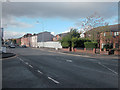

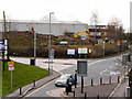
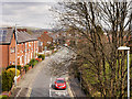
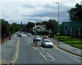
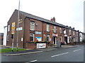
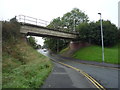
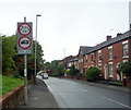
37 photos from this area
Area Information
Key information about the OL10 3FG including its size, population, and administrative classification.
- Area Type
- Postcode
- Area Size
- 1.8 hectares
- Population
- 2182
- Population Density
- 3168 people/km²
House Prices in OL10 3FG
57
Properties
£178,223
Average Sold Price
£124,950
Lowest Price
£298,000
Highest Price
Showing 57 properties
| Address | Type | Beds | Baths | Last Sale Price | Last Sale Date | |
|---|---|---|---|---|---|---|
| 57 Trippear Way, Heywood, OL10 3FG | Semi-detached | 3 | 1 | £225,000 | May 2025 | |
| 15 Trippear Way, Heywood, OL10 3FG | Detached | 3 | 2 | £260,000 | May 2025 | |
| 40 Trippear Way, Heywood, OL10 3FG | Semi-detached | 2 | 2 | £170,500 | Dec 2023 | |
| 20 Trippear Way, Heywood, OL10 3FG | Detached | 3 | 2 | £297,000 | Dec 2022 | |
| 3 Trippear Way, Heywood, OL10 3FG | Terraced | 2 | 1 | £215,000 | Sep 2022 | |
| 43 Trippear Way, Heywood, OL10 3FG | Detached | 3 | - | £290,000 | Aug 2022 | |
| 69 Trippear Way, Heywood, OL10 3FG | Detached | 3 | 2 | £298,000 | Jul 2022 | |
| 34 Trippear Way, Heywood, OL10 3FG | Semi-detached | 3 | 2 | £220,000 | Mar 2022 | |
| 45 Trippear Way, Heywood, OL10 3FG | Semi-detached | 3 | 2 | £221,000 | Feb 2022 | |
| 28 Trippear Way, Heywood, OL10 3FG | Semi-detached | 3 | - | £205,000 | Sep 2021 |
Page 1 of 6
Energy Efficiency in OL10 3FG
Amenities
Schools
| Rank | School | Type | Entry gender | Ages |
|---|
Explore more schools in this area
Go to Schools tabDemographics
Household Size
Two person
most common
Accommodation Type
Houses
most common
Tenure
62
majority
Ethnic Group
White
most common
Religion
N/A
most common
Household Composition
N/A
most common
Age
47
median
Adults (30-64 years)
most common
Household Deprivation
N/A
with no deprivation
NS-SEC
25
in Lower managerial occupations
Explore more demographic insights in this area
Go to Demographics tabPlanning
Planning Constraints
- Flood RiskPremium
- Ramsar Wetland SitesPremium
- Area of Outstanding Natural BeautyPremium
- Protected Nature ReservePremium
- Protected WoodlandPremium