Area Overview for OL10 2SX
Photos of OL10 2SX
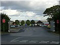
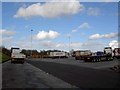
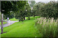
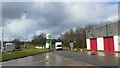

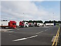


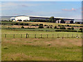
32 photos from this area
Area Information
Key information about the OL10 2SX including its size, population, and administrative classification.
- Area Type
- Postcode
- Area Size
- 38.0 hectares
- Population
- 2015
- Population Density
- 462 people/km²
House Prices in OL10 2SX
7
Properties
-
Average Sold Price
-
Lowest Price
-
Highest Price
Showing 7 properties
| Address | Type | Beds | Baths | Last Sale Price | Last Sale Date | |
|---|---|---|---|---|---|---|
| Heywood Scaffolding Services / Rossendale Scaffold & Requipment Hire, Unit L3, Birch Business Park, Whittle Lane, Heywood, OL10 2SX | Industrial | - | - | - | - | |
| Unit M, Birch Business Park, Whittle Lane, Heywood, OL10 2SX | Industrial | - | - | - | - | |
| Restore, Unit B, Birch Business Park, Whittle Lane, Heywood, OL10 2SX | Industrial | - | - | - | - | |
| Vodafone, Unit P, Birch Business Park, Whittle Lane, Heywood, OL10 2SX | miscellaneous_24hr | - | - | - | - | |
| Icon Logistics / John Smith-butler Limited / Robert Lee Distribution Ltd, Unit J, Birch Business Park, Whittle Lane, Heywood, OL10 2SX | storage_distribution | - | - | - | - | |
| Bathshop 321 Ltd, Unit K, Birch Business Park, Whittle Lane, Heywood, OL10 2SX | storage_distribution | - | - | - | - | |
| Unit G, Birch Business Park, Whittle Lane, Heywood, OL10 2SX | Industrial | - | - | - | - |
Energy Efficiency in OL10 2SX
Amenities
Schools
| Rank | School | Type | Entry gender | Ages |
|---|
Explore more schools in this area
Go to Schools tabDemographics
Household Size
Family (3-5 people)
most common
Accommodation Type
Houses
most common
Tenure
88
majority
Ethnic Group
White
most common
Religion
N/A
most common
Household Composition
N/A
most common
Age
47
median
Adults (30-64 years)
most common
Household Deprivation
N/A
with no deprivation
NS-SEC
40
in Lower managerial occupations
Explore more demographic insights in this area
Go to Demographics tabPlanning
Planning Constraints
- Flood RiskPremium
- Ramsar Wetland SitesPremium
- Area of Outstanding Natural BeautyPremium
- Protected Nature ReservePremium
- Protected WoodlandPremium