Area Overview for OL10 2NL
Photos of OL10 2NL
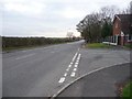
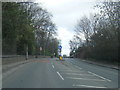
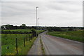
![Manchester Road [A6045] in OL10 2NL](https://images.propbar.co.uk/images/geograph/21/61/2161263_120.jpg)
17 photos from this area
Area Information
Key information about the OL10 2NL including its size, population, and administrative classification.
- Area Type
- Postcode
- Area Size
- 1.1 hectares
- Population
- 2015
- Population Density
- 462 people/km²
House Prices in OL10 2NL
8
Properties
£447,357
Average Sold Price
£2,500
Lowest Price
£805,000
Highest Price
Showing 8 properties
| Address | Type | Beds | Baths | Last Sale Price | Last Sale Date | |
|---|---|---|---|---|---|---|
| Edgecroft, 229 Manchester Road, Heywood, OL10 2NL | Detached | 4 | 1 | £460,000 | Dec 2024 | |
| 142 Manchester Road, Heywood, OL10 2NL | Detached | 4 | - | £650,000 | May 2022 | |
| 144 Manchester Road, Heywood, OL10 2NL | Retail | 4 | - | £485,000 | May 2022 | |
| Dunvegan, 140 Manchester Road, Heywood, OL10 2NL | Detached | 5 | 5 | £805,000 | Aug 2018 | |
| 148 Manchester Road, Heywood, OL10 2NL | Detached | - | - | £2,500 | Mar 2017 | |
| Selsey, 138 Manchester Road, Heywood, OL10 2NL | house | - | - | £650,000 | May 2011 | |
| 146 Manchester Road, Heywood, OL10 2NL | Detached | - | - | £79,000 | Jul 1999 | |
| Wicken Cottage, 227 Manchester Road, Heywood, OL10 2NL | house | 4 | - | - | - |
Energy Efficiency in OL10 2NL
Amenities
Schools
| Rank | School | Type | Entry gender | Ages |
|---|
Explore more schools in this area
Go to Schools tabDemographics
Household Size
Family (3-5 people)
most common
Accommodation Type
Houses
most common
Tenure
88
majority
Ethnic Group
White
most common
Religion
N/A
most common
Household Composition
N/A
most common
Age
47
median
Adults (30-64 years)
most common
Household Deprivation
N/A
with no deprivation
NS-SEC
40
in Lower managerial occupations
Explore more demographic insights in this area
Go to Demographics tabPlanning
Planning Constraints
- Flood RiskPremium
- Ramsar Wetland SitesPremium
- Area of Outstanding Natural BeautyPremium
- Protected Nature ReservePremium
- Protected WoodlandPremium