Area Overview for OL10 2DP
Photos of OL10 2DP
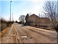
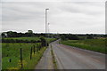
![Manchester Road [A6045] in OL10 2DP](https://images.propbar.co.uk/images/geograph/21/61/2161263_120.jpg)
17 photos from this area
Area Information
Key information about the OL10 2DP including its size, population, and administrative classification.
- Area Type
- Postcode
- Area Size
- 3676 m²
- Population
- 1318
- Population Density
- 3670 people/km²
House Prices in OL10 2DP
7
Properties
£221,100
Average Sold Price
£110,000
Lowest Price
£377,000
Highest Price
Showing 7 properties
| Address | Type | Beds | Baths | Last Sale Price | Last Sale Date | |
|---|---|---|---|---|---|---|
| 1 Birkdale Close, Heywood, OL10 2DP | Detached | 4 | 2 | £377,000 | Oct 2023 | |
| 2 Birkdale Close, Heywood, OL10 2DP | house | - | - | £296,000 | Jan 2022 | |
| 5 Birkdale Close, Heywood, OL10 2DP | house | - | - | £167,500 | May 2015 | |
| 8 Birkdale Close, Heywood, OL10 2DP | house | - | - | £155,000 | Sep 2012 | |
| 3 Birkdale Close, Heywood, OL10 2DP | Detached | 3 | 1 | £110,000 | Sep 2002 | |
| 4 Birkdale Close, Heywood, OL10 2DP | Detached | - | - | - | - | |
| 6 Birkdale Close, Heywood, OL10 2DP | Detached | - | - | - | - |
Energy Efficiency in OL10 2DP
Amenities
Schools
| Rank | School | Type | Entry gender | Ages |
|---|
Explore more schools in this area
Go to Schools tabDemographics
Household Size
Family (3-5 people)
most common
Accommodation Type
Houses
most common
Tenure
92
majority
Ethnic Group
White
most common
Religion
N/A
most common
Household Composition
N/A
most common
Age
47
median
Adults (30-64 years)
most common
Household Deprivation
N/A
with no deprivation
NS-SEC
39
in Lower managerial occupations
Explore more demographic insights in this area
Go to Demographics tabPlanning
Planning Constraints
- Flood RiskPremium
- Ramsar Wetland SitesPremium
- Area of Outstanding Natural BeautyPremium
- Protected Nature ReservePremium
- Protected WoodlandPremium