Area Overview for OL10 1LD
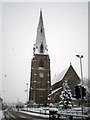
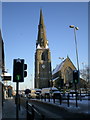
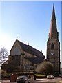
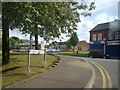
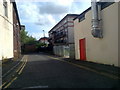
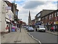
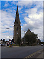
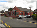
Photos of OL10 1LD


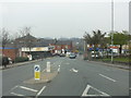
Area Information
Living in OL10 1LD means residing within a specific postcode area that covers a small residential cluster in Greater Manchester. This compact footprint of 844 m² supports a population of 1,783 people, creating a densely built environment. You are part of a neighbourhood defined by its focused nature, where homes are in close proximity to one another. The area is situated in England and serves as a precise location marker for housing in this part of the town. Daily life here revolves around this concentrated community, where distance to local facilities is minimal but the space itself is limited. Residents navigate a setting that prioritises immediate access over sprawling suburbs. The small size of the zone means you will know your neighbours well, as the sheer number of people per square kilometre suggests a tightly knit existence. You do not live in a vast district but in a distinct pocket of the wider urban landscape. This concentration influences everything from noise levels to the speed at which local news or community events travel. Understanding that OL10 1LD is a small cluster helps you set realistic expectations for the quietness and space available within your immediate surroundings. It is an environment where the town centre and your front door are always within a short journey.
- Area Type
- Postcode
- Area Size
- 844 m²
- Population
- 1783
- Population Density
- 3029 people/km²
The property market in OL10 1LD is defined by a housing stock that consists primarily of houses. Despite the small geographical size of the postcode cluster, there is a clear preference for detached or semi-detached properties over flats. This preference contrasts with the relatively low ownership level, where only 25% of residents own their homes. Consequently, the market functions largely as a rental area, even though the physical structures are predominantly houses. Prospective buyers looking at this specific area will find that the architecture aligns with traditional English housing rather than high-density urban blocks. The distinction between ownership and rental status here is significant, as it affects both local investment strategies and community stability. You are looking at a market where the physical asset is a house, but the tenure is often fleeting. This dynamic can influence street maintenance and long-term neighbourhood planning, as the owner of a house may change monthly. For those seeking to buy, your options are more limited than in areas where owner-occupation drives the market. The data confirms that you are entering a sector where the quantity of rental demand outstrips the supply of owner-occupied homes. This reality shapes the pricing and availability of properties within this 844 m² zone.
House Prices in OL10 1LD
Showing 1 properties
| Address | Type | Beds | Baths | Last Sale Price | Last Sale Date | |
|---|---|---|---|---|---|---|
| Wayland Sheet Metal And Fabrications Limited, Premier Iron Works, Rochdale Road, Heywood, OL10 1LD | Industrial | - | - | - | - |
Energy Efficiency in OL10 1LD
Your lifestyle in OL10 1LD benefits from immediate access to major retail chains and transport hubs. Within practical reach, you can shop at Tesco Heywood York, Aldi Heywood, and Morrisons Heywood. These supermarkets offer a wide range of groceries and daily essentials without the need for a long car journey. For travel, the area is close to Heywood, Rochdale Town Centre, and Rochdale Interchange, providing a Metro network link to broader districts. Rail access is available via Castleton Railway Station, Rochdale Railway Station, and Mills Hill Railway Station. These rail stations connect you to Greater Manchester and beyond with regular services. The proximity to Rochdale Interchange ensures that you can reach city centre amenities or airport connections efficiently. Your daily routine involves walking or a short drive to these key locations for shopping and employment. The presence of five notable retail and transport options within reach defines the convenience of living here. You do not need to travel far for groceries or a change of train. This accessibility supports a balanced life between home work and social engagement in the wider town.
Amenities
Schools
Families relying on education options in OL10 1LD have access to Moss Field Community School, which serves as a primary education provider. The area also includes Birtle View School, which caters to special educational needs. The presence of these two institutions indicates that the neighbourhood serves both general and special educational requirements. You do not have data on the Ofsted ratings for either school, so you must verify current grading independently. The mix of primary and special needs provision suggests that the local demographic includes young children and those with specific learning or physical requirements. Parents living in this cluster can choose between a standard primary education or specialised support depending on their child's needs. The proximity of these schools means that daily journeys to education are short, fitting the compact nature of the residential area. You should plan your route to Moss Field Community School for younger children and ensure Birtle View School is accessible if you require special provisions. These are the only schools listed in your immediate vicinity, making them the focal point for family life around OL10 1LD.
| Rank | School | Type | Entry gender | Ages |
|---|
Explore more schools in this area
Go to Schools tabDemographics
The community in OL10 1LD is shaped by a median age of 47 years, with the most common age range being adults between 30 and 64 years. This indicates a neighbourhood dominated by established families and professionals rather than young students or retirees. House ownership stands at 25%, meaning three-quarters of residents live in rental accommodation. The predominant accommodation type consists of houses, which suggests a demand for separate homes despite the small cluster size. The predominant ethnic group is White, reflecting the historical settlement patterns of this part of Greater Manchester. You should note that only a quarter of homes are owner-occupied, highlighting a market where renting is the primary mode of tenure. The high population density of 2,112,628 people per km², calculated from the area size, points to a very compact urban block where living space is the premium commodity. This demographic profile Create a stable community of working-age adults. The age distribution implies that local amenities likely cater to families with school-age children or those supporting dependent relatives. The mix of renters and homeowners in a house-dominated stock creates a diverse living situation within the cluster.
Household Size
Accommodation Type
Tenure
Ethnic Group
Religion
Household Composition
Age
Household Deprivation
NS-SEC
Explore more demographic insights in this area
Go to Demographics tabPlanning
Planning Constraints
- Flood RiskPremium
- Ramsar Wetland SitesPremium
- Area of Outstanding Natural BeautyPremium
- Protected Nature ReservePremium
- Protected WoodlandPremium