Area Overview for OL1 4SJ
Photos of OL1 4SJ
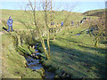
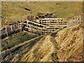
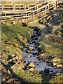
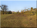


35 photos from this area
Area Information
Key information about the OL1 4SJ including its size, population, and administrative classification.
- Area Type
- Postcode
- Area Size
- 9919 m²
- Population
- 2751
- Population Density
- 1638 people/km²
House Prices in OL1 4SJ
11
Properties
£169,105
Average Sold Price
£105,000
Lowest Price
£270,000
Highest Price
Showing 11 properties
| Address | Type | Beds | Baths | Last Sale Price | Last Sale Date | |
|---|---|---|---|---|---|---|
| 12 Glebe Lane, Oldham, OL1 4SJ | Semi-detached | 4 | 3 | £270,000 | Mar 2025 | |
| 11 Glebe Lane, Oldham, OL1 4SJ | Terraced | 4 | 2 | £245,000 | Mar 2024 | |
| 3 Glebe Lane, Oldham, OL1 4SJ | Terraced | 2 | - | £150,000 | Sep 2022 | |
| 15 Glebe Lane, Oldham, OL1 4SJ | house | - | - | £178,000 | Apr 2021 | |
| 14 Glebe Lane, Oldham, OL1 4SJ | house | 4 | 3 | £185,000 | Jun 2018 | |
| 5 Glebe Lane, Oldham, OL1 4SJ | Detached | - | - | £124,950 | Nov 2007 | |
| 4 Glebe Lane, Oldham, OL1 4SJ | Terraced | - | - | £105,000 | Jul 2006 | |
| 16 Glebe Lane, Oldham, OL1 4SJ | Terraced | - | - | £150,999 | Dec 2005 | |
| 10 Glebe Lane, Oldham, OL1 4SJ | Terraced | 4 | 2 | £112,995 | Feb 2003 | |
| 2 Glebe Lane, Oldham, OL1 4SJ | Terraced | - | - | - | - |
Page 1 of 2
Energy Efficiency in OL1 4SJ
Amenities
Schools
| Rank | School | Type | Entry gender | Ages |
|---|
Explore more schools in this area
Go to Schools tabDemographics
Household Size
Family (3-5 people)
most common
Accommodation Type
Houses
most common
Tenure
74
majority
Ethnic Group
White
most common
Religion
N/A
most common
Household Composition
N/A
most common
Age
47
median
Adults (30-64 years)
most common
Household Deprivation
N/A
with no deprivation
NS-SEC
28
in Lower managerial occupations
Explore more demographic insights in this area
Go to Demographics tabPlanning
Planning Constraints
- Flood RiskPremium
- Ramsar Wetland SitesPremium
- Area of Outstanding Natural BeautyPremium
- Protected Nature ReservePremium
- Protected WoodlandPremium