Area Overview for OL1 4HR
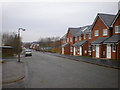
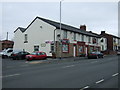
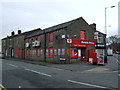
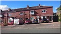
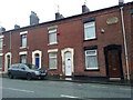
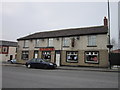
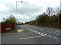
Photos of OL1 4HR


Area Information
OL1 4HR is a distinct residential cluster situated within England, covering just over 0.01 square kilometres. Despite its tiny footprint of 9,087 square metres, the area accommodates a population of 1,816 people. This creates an extremely dense living environment with a population density reaching 199,857 people per square kilometre. You are looking at a specific postcode area defined more by its place in the OL1 postcode district than by a physical landscape of wide streets or expansive grounds. Life here is characterised by a high concentration of neighbours in a very compact space. The area represents a micro-world into which a significant number of households are packed. When you consider buying a home in OL1 4HR, you must account for how 1,816 residents occupy less than ten thousand square metres of space. This density defines the daily rhythm of the neighbourhood. There is little physical separation between properties, and the experience of living in this specific cluster differs from broader suburban zones. The sheer concentration of people within such a limited boundary creates a unique urban feel. Any prospective buyer needs to understand that the charm of this locality comes from its intense compactness rather than sprawling development.
- Area Type
- Postcode
- Area Size
- 9087 m²
- Population
- 1816
- Population Density
- 3604 people/km²
Houses dominate the housing stock in OL1 4HR, forming the primary accommodation type for residents in this postcode sector. With 46% of homes owned outright or with a mortgage, the market shows a near-even split between owner-occupiers and potential tenants. This balance indicates that while there is a substantial base of homeowners, rental availability remains significant for those entering the market without savings. The total area covers only 9,087 square metres, which limits the variety of property sizes typically found in larger suburbs. You can expect the housing stock to be tightly packed, reflecting the population density of nearly 200,000 people per square kilometre. The presence of existing homeowners suggests a market where legacy properties are common. Considering the 1,816 people living in this small zone, supply may be constrained. If you are looking for homes in OL1 4HR, you are likely viewing established properties rather than new-build developments. The accommodation type specifically listed as houses confirms that flats or apartments are not the standard here. This market structure suits buyers seeking a traditional home environment over high-density living.
House Prices in OL1 4HR
Showing 31 properties
| Address | Type | Beds | Baths | Last Sale Price | Last Sale Date | |
|---|---|---|---|---|---|---|
| 247 Ripponden Road, Oldham, OL1 4HR | Terraced | 2 | 1 | £143,000 | Mar 2023 | |
| 233 Ripponden Road, Oldham, OL1 4HR | house | - | - | £149,950 | Sep 2021 | |
| 207 Ripponden Road, Oldham, OL1 4HR | house | - | - | £89,000 | Aug 2019 | |
| 249 Ripponden Road, Oldham, OL1 4HR | Terraced | 3 | - | £68,000 | Oct 2016 | |
| 229 Ripponden Road, Oldham, OL1 4HR | Terraced | 3 | - | £70,000 | Apr 2014 | |
| 255 Ripponden Road, Oldham, OL1 4HR | Terraced | - | - | £150,000 | Mar 2007 | |
| 227 Ripponden Road, Oldham, OL1 4HR | Terraced | 4 | 1 | £55,000 | Jan 2007 | |
| 209 Ripponden Road, Oldham, OL1 4HR | house | - | - | £33,000 | Jan 2003 | |
| 231 Ripponden Road, Oldham, OL1 4HR | Terraced | 3 | 1 | - | - | |
| 211 Ripponden Road, Oldham, OL1 4HR | house | 3 | - | - | - |
Energy Efficiency in OL1 4HR
Residents of OL1 4HR benefit from a range of amenities located within practical reach across Oldham and the surrounding transport links. For shopping needs, five major retail outlets are nearby, including Asda Oldham, Tesco Oldham, and Co-op Moorside. These chains provide comprehensive options for groceries and daily necessities without requiring a long journey. Transport connectivity is strong with access to five key metro stations, notably Derker, Oldham Mumps, and Oldham Central. These stations offer direct links into Greater Manchester and beyond. Rail access is also available through Greenfield Railway Station, Mossley Railway Station, and Mills Hill Railway Station, which serves commuters travelling to Manchester or Leeds. This network of five metro stations and five rail stations ensures that isolation is not an issue for locals. The cluster of five Asda, Tesco, and Co-op stores means you stay on your favourite budget-friendly chains. Living in OL1 4HR gives you immediate access to these large-scale retail spaces while relying on a dense web of train and metro lines for longer trips.
Amenities
Schools
You have access to a few educational institutions within practical reach of OL1 4HR. Watersheddings Primary School serves as a local option for younger children. Kingsland School is another institution listed nearby, categorized as a secondary or specialist school depending on its current structure. Woodlands Primary Academy is a third option and holds a good Ofsted rating for its standard of education. This mix includes two primary schools and one other school type, offering choices for different family needs. The presence of Woodlands Primary Academy with a good rating is a positive feature for families considering the area. However, the distance between these schools and the specific OL1 4HR cluster must be verified for each individual home. The variety of school types means you can find primary education locally without travelling far to other zones. When you evaluate living in OL1 4HR, the proximity to these specific names – Watersheddings, Kingsland, and Woodlands – is a key factor. The good rating at Woodlands Primary Academy provides reassurance regarding the quality of education available nearby.
| Rank | School | Type | Entry gender | Ages |
|---|
Explore more schools in this area
Go to Schools tabDemographics
The community within OL1 4HR skews noticeably towards maturity. The median age sits at 47 years, indicating that families often include older parents or that younger adults move out to work elsewhere. Most residents fall within the adult age range of 30 to 64 years, suggesting a population that has established careers and potentially begun retirement planning. About 46% of households in OL1 4HR are owner-occupied, meaning nearly half of the population owns their home outright or with a mortgage. This figure places the area slightly in balance between buying owners and renters. The predominant accommodation type consists of houses, which aligns with the demographic profile of a settled adult population. White residents make up the predominant ethnic group in this cluster, reflecting the historical construction and location of the housing stock. The mix of house ownership and age suggests a community where stability is common. Buyers should note that the median age of 47 means the primary school demographic may be smaller than in younger areas, with children likely having moved to secondary education or university by the time they were in their early twenties and forties.
Household Size
Accommodation Type
Tenure
Ethnic Group
Religion
Household Composition
Age
Household Deprivation
NS-SEC
Explore more demographic insights in this area
Go to Demographics tabPlanning
Planning Constraints
- Flood RiskPremium
- Ramsar Wetland SitesPremium
- Area of Outstanding Natural BeautyPremium
- Protected Nature ReservePremium
- Protected WoodlandPremium