Area Overview for OL1 3LJ
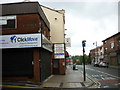
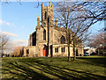
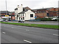
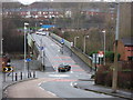
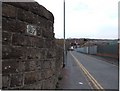
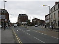
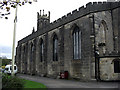
Photos of OL1 3LJ


Area Information
Living in OL1 3LJ involves settled residential life within a very specific, compact post-code cluster. This area covers 6,731 square metres, creating a dense neighbourhood where proximity defines daily routines. The total population stands at 2,585 people, resulting in a population density of 384,072 per square kilometre. Such figures indicate a tightly woven community where facilities and neighbours are immediately reachable on foot. Prospective buyers will find that space is at a premium here, as the physical footprint is small relative to the number of residents. Life in this postcode is characterised by convenience rather than spacious gardens or open green belts. The immediate surroundings are defined by the concentration of households within this limited boundary. You inhabit an environment where the distinction between your home and the local amenities is minimal. The area functions as a distinct residential pocket within the wider urban sprawl of Oldham. Understanding the scale of OL1 3LJ is essential before considering the logistics of buying a property here. The high density means you live among your neighbours noise and viewlines are more likely to be interrupted than in sparse suburbs. Yet, this density also provides instant access to services without needing a car for essential trips. The area is a microcosm of urban living where efficiency underpins the rhythm of existence.
- Area Type
- Postcode
- Area Size
- 6731 m²
- Population
- 2585
- Population Density
- 4892 people/km²
The property market in OL1 3LJ is defined by traditional housing forms and a significant segment of owner-occupiers. Houses comprise the primary accommodation type, meaning terraced rows or stand-alone properties dominate the landscape of this postcode. With 47% home ownership, nearly half of the residents have purchased these homes, likely locking in their families for the long term. This high level of ownership often stabilises rents and creates a sense of permanence that spreads through the community. Buyers looking at homes in OL1 3LJ should expect a legacy of family living rather than a transient rental market. The small area size of 6,731 square metres limits the variety of building styles available for purchase. You are entering a market where supply is fixed by the physical boundaries of the post code. Existing properties are likely well-established, reflecting the 47-year-old median age of the residents who bought them.If you are looking to move here, competition for well-maintained houses may be fierce among owner-occupiers seeking to extend their tenure. The density suggests that land for new builds is virtually non-existent within this specific postcode cluster. Therefore, buying here usually means renovating or purchasing an existing traditional home. The market values established character and location over new construction.
House Prices in OL1 3LJ
Showing 2 properties
| Address | Type | Beds | Baths | Last Sale Price | Last Sale Date | |
|---|---|---|---|---|---|---|
| Howarth Timber Merchants, Shaw Road, Oldham, OL1 3LJ | shop | - | - | - | - | |
| Austin And Co (oldham) Ltd, Shaw Road, Oldham, OL1 3LJ | Industrial | - | - | - | - |
Energy Efficiency in OL1 3LJ
Amenities
Schools
Families considering schools near OL1 3LJ will have access to Mayfield Primary School. This institution is a primary school situated close to the area. Its latest Ofsted rating is satisfactory, indicating that the education provided meets the national standards required. This is the only school listed in the immediate vicinity of the postcode. Secondary schools lie further afield, not within the immediate scope of this specific data set. For children who are not yet of primary school age, transport logistics to Mayfield will be the main planning requirement. The satisfactory rating means the school is acceptable but not outstanding, a common status for local provision. Parents in OL1 3LJ must plan their commutes carefully, as the density of the area is high but educational provision is limited to this single nearby name. Your children will attend Mayfield Primary School if they fall within the catchment. This singular option dictates a strong reliance on the performance of this one institution for all social and academic interaction with peers.
| Rank | School | Type | Entry gender | Ages |
|---|
Explore more schools in this area
Go to Schools tabDemographics
The community in OL1 3LJ is distinctly mature, with a median age of 47 years old. Adults aged between 30 and 64 years represent the most common age range within the population. This demographic profile suggests a neighbourhood dominated by older family units, empty nesters, and retired residents rather than young professionals. Home ownership stands at 47% of the total population, indicating that just under half of the residents own their property outright. The remaining residents likely rent their accommodation, contributing to a mix of stability and mobility within the streets. Houses form the predominant type of accommodation, confirming that semi-detached and detached properties characterize the street layout. White ethnicity remains the predominant ethnic group, moulding the cultural fabric of the local shops and public spaces. There are no statistics provided regarding deprivation levels, so you must rely on external sources for that specific metric. However, the age and ownership data paint a clear picture of established roots. Families with older children or those without school-going children will find a sympathetic neighbourly atmosphere. The housing stock is generally suited to single-storey access or ground-floor living given the house-dominated architecture. This demographic mix means the local grocers and cafes will cater to mature tastes rather than youth-oriented trends.
Household Size
Accommodation Type
Tenure
Ethnic Group
Religion
Household Composition
Age
Household Deprivation
NS-SEC
Explore more demographic insights in this area
Go to Demographics tabPlanning
Planning Constraints
- Flood RiskPremium
- Ramsar Wetland SitesPremium
- Area of Outstanding Natural BeautyPremium
- Protected Nature ReservePremium
- Protected WoodlandPremium