Area Overview for OL1 2RR
Photos of OL1 2RR
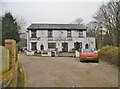
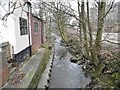
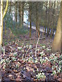
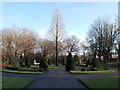
58 photos from this area
Area Information
Key information about the OL1 2RR including its size, population, and administrative classification.
- Area Type
- Postcode
- Area Size
- 17.4 hectares
- Population
- 1485
- Population Density
- 881 people/km²
House Prices in OL1 2RR
30
Properties
£258,200
Average Sold Price
£80,000
Lowest Price
£500,000
Highest Price
Showing 30 properties
| Address | Type | Beds | Baths | Last Sale Price | Last Sale Date | |
|---|---|---|---|---|---|---|
| 28 Chadderton Fold, Chadderton, OL1 2RR | Terraced | 2 | 1 | £262,250 | Feb 2025 | |
| 13 Chadderton Fold, Chadderton, OL1 2RR | Terraced | 2 | 1 | £280,000 | May 2024 | |
| 18 Chadderton Fold, Chadderton, OL1 2RR | Semi-detached | 3 | 2 | £355,000 | Apr 2024 | |
| Park View, Chadderton Fold, Chadderton, OL1 2RR | Detached | 4 | 2 | £460,000 | Mar 2023 | |
| 50 Chadderton Fold, Chadderton, OL1 2RR | house | - | - | £500,000 | Feb 2022 | |
| 14 Chadderton Fold, Chadderton, OL1 2RR | house | - | - | £298,950 | Aug 2021 | |
| 17 Chadderton Fold, Chadderton, OL1 2RR | Semi-detached | 2 | 1 | £200,000 | Oct 2020 | |
| 27 Chadderton Fold, Chadderton, OL1 2RR | Bungalow | 2 | 2 | £80,000 | Jul 2016 | |
| 55 Chadderton Fold, Chadderton, OL1 2RR | Semi-detached | 3 | - | £230,000 | Apr 2015 | |
| 29 Chadderton Fold, Chadderton, OL1 2RR | house | 2 | - | £102,000 | Apr 2015 |
Page 1 of 3
Energy Efficiency in OL1 2RR
Amenities
Schools
| Rank | School | Type | Entry gender | Ages |
|---|
Explore more schools in this area
Go to Schools tabDemographics
Household Size
Family (3-5 people)
most common
Accommodation Type
Houses
most common
Tenure
93
majority
Ethnic Group
White
most common
Religion
N/A
most common
Household Composition
N/A
most common
Age
47
median
Adults (30-64 years)
most common
Household Deprivation
N/A
with no deprivation
NS-SEC
41
in Lower managerial occupations
Explore more demographic insights in this area
Go to Demographics tabPlanning
Planning Constraints
- Flood RiskPremium
- Ramsar Wetland SitesPremium
- Area of Outstanding Natural BeautyPremium
- Protected Nature ReservePremium
- Protected WoodlandPremium