Area Overview for Norwood Ward
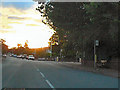
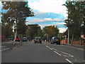
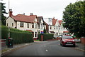
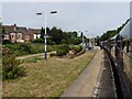
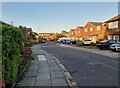
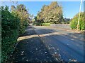
Photos of Norwood Ward


Area Information
Living in Norwood Ward offers a distinctly quiet experience within the borough of Lewisham. This district covers an area of 3.6 km² and maintains a relatively contained population of 4,526 residents. The density here stands at 1,242 people per square kilometre, meaning the neighbourhood feels less crowded than many parts of Greater London. You will find a community where daily life moves at a measured pace compared to more bustling urban zones. The limited size of the ward suggests that amenities and services are likely within easy walking distance for most households. This area does not suffer from the chaos or noise often associated with high-density city living. Instead, it provides a more residential environment where neighbours are probably known to one another. The low population figure indicates a stable, perhaps even quiet, domestic setting. Prospective buyers should feel confident that they are exploring a specific, manageable part of London rather than a vast, sprawling district. The character of Norwood Ward is defined by its compact footprint and its role as a defined unit within the larger local government structure. You enter a zone where the scale of life is intimate and the community is tightly knit. The area functions as a cohesive ward where the needs of over four thousand residents are managed with precision. This makes the experience of living here predictable and straightforward for anyone considering a move.
- Area Type
- District Borough Unitary Ward
- Area Size
- 3.6 km²
- Population
- 4526
- Population Density
- 1242 people/km²
Demographics
The community profile of Norwood Ward is shaped significantly by its age distribution. The median age for residents reaches 70 years old, which places this ward well above the national average for Greater London. This high figure suggests that a substantial portion of the population consists of older adults. While the specific breakdown of the total age range requires further detail, the median alone signals a settlement that is not focused on building a young family demographic. Home ownership is a defining feature of this neighbourhood, with 70% of residents owning their homes outright. This high rate implies long-term stability within the community, as most households have been established for many years. The low level of private renting aligns with the older age profile, as many seniors prefer to remain in properties they have purchased decades ago. Accommodation types are not explicitly detailed in public records for this specific ward, but the ownership rate strongly hints at terraced or semi-detached family homes typical of this period. The house composition data confirms that tenure is the primary metric available for analysis. You will find very few young professionals or students compared to other London districts because the demographic skew is heavily weighted towards the elderly. This environment suits those seeking a calm retirement lifestyle or family seeking a quiet, elder-rich neighbourhood. The social fabric is likely centred around parks, local shops, and community halls rather than nightlife venues.
Household Size
Accommodation Type
Tenure
Ethnic Group
Religion
Household Composition
Age
Household Deprivation
NS-SEC
Explore more demographic insights in this area
Go to Demographics tabPlanning
Planning Constraints
- Flood RiskLocked
- Ramsar Wetland SitesLocked
- Area of Outstanding Natural BeautyLocked
- Protected Nature ReserveLocked
- Protected WoodlandLocked
- Crime RiskLocked