Area Overview for North Turton
Photos of North Turton
Area Information
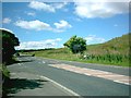
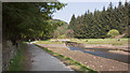
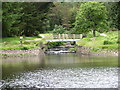
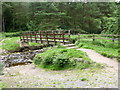
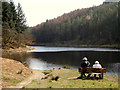
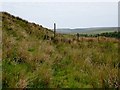
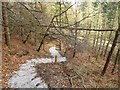
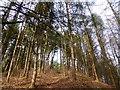
North Turton is a civil parish located in the North West of England, situated north of Bolton and south of Blackburn. This area covers 53.9 km² and forms part of the historic township of Turton within the ancient parish of Bolton le Moors. Historically, the region comprised separate sections before administrative changes in 1974 merged North Turton into Blackburn Borough while South Turton joined Bolton. The modern community includes settlements such as Belmont, Edgworth, Chapeltown, and Entwistle. Residents live in a rural setting where history meets quiet countryside living. Saint Anne's Chapel in Chapeltown dates back to around 1111 and has been rebuilt multiple times, serving as a landmark for those living in North Turton. The parish has maintained its distinct identity through decades of local governance evolution. You will find a community rooted in Lancashire heritage rather than urban pace. The landscape remains largely open, offering residents a retreat from city life without complete isolation. Understanding the historical context of North Turton helps buyers appreciate the unique character of their potential new home. The area's coordinate location places it strategically between two larger towns, offering potential access to wider regional services while preserving local tranquility. Living in North Turton means embracing a place defined by its historical depth and geographical position in the North West.
- Area Type
- Parish
- Area Size
- 53.9 km²
- Population
- 1334
- Population Density
- 1170 people/km²
Demographics
The community within the parish of North Turton exhibits a distinct age profile with a median age of 70 years. This demographic shifts the neighbourhood atmosphere toward a quieter, retired lifestyle compared to younger urban areas. Eighty-six per cent of households in North Turton own their homes outright or with a mortgage. This high ownership rate indicates a stable, long-term resident base rather than a transient population. The total population stands at 1,334 people, creating a close-knit environment where neighbours know each other. Accommodation types and household compositions reflect the older demographic make-up of the area. The population density reaches 1,170 people per km² across the parish land. This density suggests manageable distances between homes but maintains a low footprint relative to major cities. Residents of North Turton likely form community connections through local events and parish activities rather than high-rise social mixes. The homogeneity in age and ownership creates a consistent community feel. Buyers considering North Turton should note that the area appeals primarily to older adults or those seeking retirement locations. The total population figure of 1,334 confirms the suburb's status as a small, contained community. Historical boundaries encompassing Belmont, Edgworth, Chapeltown, and Entwistle contribute to this established social fabric. You will not find the diversity of a city centre here, but you will find a settled, elderly population with deep local roots. Living in North Turton connects you to a demographic that values stability and community over transient urban energy.
Household Size
Accommodation Type
Tenure
Ethnic Group
Religion
Household Composition
Age
Household Deprivation
NS-SEC
Explore more demographic insights in this area
Go to Demographics tabPlanning
Planning Constraints
- Flood RiskPremium
- Ramsar Wetland SitesPremium
- Area of Outstanding Natural BeautyPremium
- Protected Nature ReservePremium
- Protected WoodlandPremium
- Crime RiskPremium