Area Overview for Newton-le-Willows East Ward
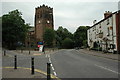
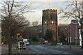
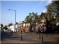
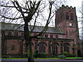
Photos of Newton-le-Willows East Ward


Area Information
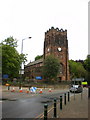
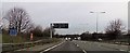
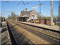
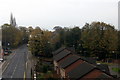
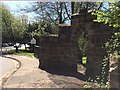
Living in Newton-le-Willows East Ward offers a distinct experience on the eastern edge of the market town of Newton-le-Willows. This electoral ward sits within the Metropolitan Borough of St Helens in Merseyside, forming a specific community on the frontier towards Greater Manchester. You will find the area is located off the A580 East Lancashire Road, providing convenient access between Liverpool and Manchester while bordering Wigan to the north and Warrington to the south. The geography is compact, covering just 7.5 square kilometres. Despite its small size, the population reaches 1,965 people, creating a neighbourhood where residents know one another. The location benefits from historical significance, with a Roman road lying beneath the nearby Wargrave area and roots dating back to the 12th century. Urban development here accelerated in the mid-19th century to support the Liverpool and Manchester Railway. Today, the ward maintains a density of 263 people per square kilometre. This setting provides a settled environment for those who wish to live near key transport links without moving into a larger urban centre. The proximity to both cities allows you to access major economic hubs while remaining rooted in this specific Merseyside locality.
- Area Type
- District Borough Unitary Ward
- Area Size
- 7.5 km²
- Population
- 1965
- Population Density
- 263 people/km²
Demographics
The community in Newton-le-Willows East Ward is defined by a very settled population, with a median age of 70 years old. You should expect a neighbourhood dominated by older residents and those living in a later stage of life. The ward recorded a total population of 1,965 according to the 2021 census. Home ownership is extremely high compared to many other regions, with 65% of households owning their property outright or with a mortgage. Rarely do you see large private rental blocks smashing through such figures. The lower density of 263 people per square kilometre reflects a non-dense living pattern. There are no details available regarding specific age ranges beyond the median, nor are there figures for predominant ethnic groups or religious affiliations provided in the current dataset. The household composition data is listed as total, indicating aggregated information without specific breakdowns for couples or families. This demographic profile suggests a stable area where long-term residents value tenure. High home ownership rates typically correlate with communities where people stay put rather than moving frequently. The age profile alone means that schools might serve a limited local catchment or rely heavily on pupils boarding from elsewhere.
Household Size
Accommodation Type
Tenure
Ethnic Group
Religion
Household Composition
Age
Household Deprivation
NS-SEC
Explore more demographic insights in this area
Go to Demographics tabPlanning
Planning Constraints
- Flood RiskPremium
- Ramsar Wetland SitesPremium
- Area of Outstanding Natural BeautyPremium
- Protected Nature ReservePremium
- Protected WoodlandPremium
- Crime RiskPremium