Area Overview for New Longton & Hutton East Ward
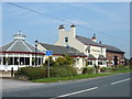
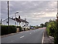
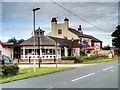
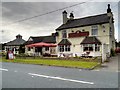
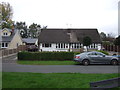
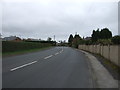
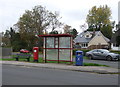
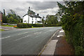
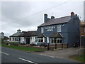
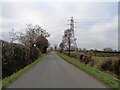
Photos of New Longton & Hutton East Ward


Area Information
Living in New Longton & Hutton East Ward offers a quiet suburban experience for those commuting to Preston. This rural ward lies within the South Ribble district of Lancashire, encompassing two distinct settlements approximately 6 km south west of Preston. New Longton serves as a relatively modern village, having developed primarily after the railway era, while Hutton retains older medieval roots dating back to 1150 AD. Together, these communities form a cohesive residential patch with a total population of 1,302 people spread across 7.6 km². Daily life here is characterised by a distinct lack of major commercial activity, as both areas function primarily as dormitory settlements for Preston workers. You can expect a leafy environment where modern residential housing developments dominate the landscape rather than historic high streets. The villages developed significantly from the 1940s onwards when post-war housing expansion transformed former agricultural land and scattered farms. While you will not find significant employers or commercial centres within the ward boundaries yourself, the area benefits from a safe environment with below-average crime rates. Your daily commute relies heavily on private transport or irregular bus services, as the main rail line closed in 1964. This settled, quiet character makes the area suitable for buyers seeking a low-stress residential environment on the periphery of a larger city.
- Area Type
- District Borough Unitary Ward
- Area Size
- 7.6 km²
- Population
- 1302
- Population Density
- 1263 people/km²
Demographics
The community in New Longton & Hutton East Ward possesses a notably older age profile compared to many urban areas. Data for the area indicates a median age of 70 years, reflecting a significant concentration of older residents living in permanent homes. This demographic structure suggests a neighbourhood where many inhabitants have lived for decades rather than young professionals or transient families seeking short-term tenancies. The population stability contributes to a consistent community feel that has evolved from its agricultural origins into a settled residential zone. Home ownership rates stand at 87% within the ward. This high figure indicates that the vast majority of residents own their properties rather than renting. Such a statistic typically points to a stock dominated by older generations who purchased homes during the major development phases of the mid-20th century or later. You are more likely to encounter long-term residents than a transient rental market. The area does not display specific data on household composition diversity or predominant ethnic groups in the provided records. Consequently, the visible social fabric appears anchored by a steady, largely property-owning population anchored in their homes. For those considering moving here, the expectation is a stable, established community where property values have historically reflected strong local investment by owners rather than fluctuating rental yields.
Household Size
Accommodation Type
Tenure
Ethnic Group
Religion
Household Composition
Age
Household Deprivation
NS-SEC
Explore more demographic insights in this area
Go to Demographics tabPlanning
Planning Constraints
- Flood RiskPremium
- Ramsar Wetland SitesPremium
- Area of Outstanding Natural BeautyPremium
- Protected Nature ReservePremium
- Protected WoodlandPremium
- Crime RiskPremium