Area Overview for Netherpool Ward
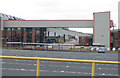
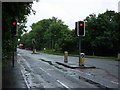
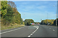
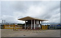
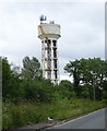
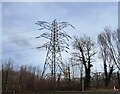
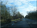
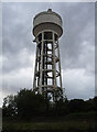
Photos of Netherpool Ward

Area Information
Netherpool Ward sits within Cheshire West and Chester, a unitary authority in North West England. The ward covers approximately 9.8 square kilometres and holds a population of around 1,246 residents. Located near Ellesmere Port, this district offers a specific character defined by its quiet scale and rural adjacency. Living in Netherpool Ward means residing in a community where the population density is naturally low due to the area's size. The location sits at coordinates 53.29758 and -2.911674, placing it strategically close to broader transport links while maintaining a distinct local identity. This ward functions as a residential enclave rather than a commercial hub. Its compact footprint of just under 10 square kilometres results in a neighbourhood where distances to local points of interest remain manageable. You will find that daily life here revolves around proximity rather than urban sprawl. The area represents a settled community within the wider Ellesmere Port and Neston region. Buyers considering homes in Netherpool Ward are entering a market defined by these precise geographical boundaries and a stable, long-term resident population. The ward lacks the complexity of larger districts, offering a focused environment for those seeking a specific lifestyle without the congestion of larger towns. The community in Netherpool Ward displays a distinctly older demographic profile compared to many other parts of the United Kingdom. The median age for residents stands at 70 years, indicating that two-thirds of the population is middle-aged or older. Age data confirms this skewed distribution, with the total age range reflecting a mature society. You will likely encounter a neighbourhood where the streets are frequented by retirees rather than young families or professionals. Home ownership levels stand at 61%, showing that a majority of residents have purchased their properties outright. This high rate of ownership suggests strong roots within the village. The remaining 39% of households represent the rental sector, providing accommodation for those not yet settled. Data on ethnicity, religion, and specific household compositions are available in full demographic records, though the overwhelming age statistic shapes the social fabric. Understanding this age profile is vital when assessing schools near Netherpool Ward, as demand will differ from areas with many young children. The demographic landscape points to a stable, senior-focused community where long-term residents maintain a significant presence in local institutions and services. The housing landscape in Netherpool Ward is defined by a significant concentration of owner-occupied homes. With 61% of households owning their residences, the ward functions primarily as an established residential market rather than a transient rental zone. This high ownership rate typically indicates a stock of properties bought with long-term use in mind, often featuring cottages, bungalows, or suburbs fitted to older owners. When viewing homes in Netherpool Ward, you will notice that the market is dominated by private investment rather than landlords seeking short-term tenants. The remaining 39% of properties available for rent cater to a smaller segment of the population, likely including younger individuals transitioning into the area or those seeking flexibility. The architecture and layout of accommodation align with the demographic reality of an older community. Buyers should expect a market with fewer new builds and a higher prevalence of existing structures. Understanding that the local housing stock is predominantly owned by residents helps clarify the price dynamics and the availability of payday rentals. The property market here reflects a demand for stability and permanence rather than frequent turnover. Digital connectivity for residents of Netherpool Ward is robust, with fixed broadband quality scoring 92 out of 100. This excellent score means you can expect fast and reliable internet speeds suitable for streaming, video calls, and remote work. High-performance broadband is crucial for modern households, and Netherpool Ward meets this standard comfortably. You do not need to worry about connectivity issues hindering your daily digital routines. While the area is rural, the infrastructure supports heavy data usage without significant lag or dropouts. This level of performance ensures that working from home remains a viable option for most residents. The combination of a quiet residential setting and top-tier internet speeds creates an ideal environment for digital nomads or those balancing home and office roles. Future-proofing your home is essential when buying, and the current infrastructure in this ward provides that security. Neighbours can rely on consistent connections for everything from online banking to entertainment systems. The digital landscape here lags behind no one, ensuring that the rural location does not come at the cost of technological isolation. Residents of Netherpool Ward must consider two primary environmental and safety factors when evaluating the area. The flood risk assessment presents a critical concern, with a score of 47.65 out of 100. This indicates a high flood risk coverage across the ward. You should verify specific property locations carefully, as parts of the area are susceptible to water inundation. This is a significant factor for potential homebuyers and may affect insurance premiums and future planning. Regarding wildlife protection, the area contains Ramsar wetland sites, which trigger a warning level for planning constraints. Further protected status applies to a small fraction of the land, comprising 0.57% of the area designated as protected woodland. While these designations protect the natural environment, they can sometimes restrict development in the vicinity. In terms of crime, the ward holds a warning level with a risk score of 64 out of 100. This places medium crime risk into context alongside standard security precautions. You should not expect a crime-free zone, but the rate remains around the average for similar regions. Balancing the environmental warnings with the moderate crime statistics provides a clear picture of the practical realities of safety in Netherpool Ward. What is the community feel like in Netherpool Ward?The community is mature and settled, with a median resident age of 70. Sixty-one per cent of households own their homes, indicating stable, long-term residents rather than a transient population. The ward supports a quiet lifestyle within a 9.8 km² area near Ellesmere Port. How is the transport and internet infrastructure?Fixed broadband connectivity is excellent, scoring 92 out of 100 for quality. This ensures reliable internet for remote work and streaming. While physical transport links rely on proximity to Ellesmere Port, digital connectivity removes isolation for working from home. Are there significant safety risks I should know about?Crime risk is moderate, rated as a warning level with a score of 64 out of 100, indicating rates around the national average. However, the ward faces a critical safety issue regarding flood risk, with a high level of coverage and a score of 47.65. Awareness of these factors is essential before purchasing. Who typically lives in this ward?The population is predominantly older, with the overall age distribution skewed towards seniors. It is not a young family area, as two-thirds of residents are middle-aged or older. This contrasts with neighbourhoods that host many schools near Netherpool Ward, which would serve a younger demographic.
- Area Type
- District Borough Unitary Ward
- Area Size
- 9.8 km²
- Population
- Not available
- Population Density
- Not available
Demographics
The community in Netherpool Ward displays a distinctly older demographic profile compared to many other parts of the United Kingdom. The median age for residents stands at 70 years, indicating that two-thirds of the population is middle-aged or older. Age data confirms this skewed distribution, with the total age range reflecting a mature society. You will likely encounter a neighbourhood where the streets are frequented by retirees rather than young families or professionals. Home ownership levels stand at 61%, showing that a majority of residents have purchased their properties outright. This high rate of ownership suggests strong roots within the village. The remaining 39% of households represent the rental sector, providing accommodation for those not yet settled. Data on ethnicity, religion, and specific household compositions are available in full demographic records, though the overwhelming age statistic shapes the social fabric. Understanding this age profile is vital when assessing schools near Netherpool Ward, as demand will differ from areas with many young children. The demographic landscape points to a stable, senior-focused community where long-term residents maintain a significant presence in local institutions and services. The housing landscape in Netherpool Ward is defined by a significant concentration of owner-occupied homes. With 61% of households owning their residences, the ward functions primarily as an established residential market rather than a transient rental zone. This high ownership rate typically indicates a stock of properties bought with long-term use in mind, often featuring cottages, bungalows, or suburbs fitted to older owners. When viewing homes in Netherpool Ward, you will notice that the market is dominated by private investment rather than landlords seeking short-term tenants. The remaining 39% of properties available for rent cater to a smaller segment of the population, likely including younger individuals transitioning into the area or those seeking flexibility. The architecture and layout of accommodation align with the demographic reality of an older community. Buyers should expect a market with fewer new builds and a higher prevalence of existing structures. Understanding that the local housing stock is predominantly owned by residents helps clarify the price dynamics and the availability of payday rentals. The property market here reflects a demand for stability and permanence rather than frequent turnover. Digital connectivity for residents of Netherpool Ward is robust, with fixed broadband quality scoring 92 out of 100. This excellent score means you can expect fast and reliable internet speeds suitable for streaming, video calls, and remote work. High-performance broadband is crucial for modern households, and Netherpool Ward meets this standard comfortably. You do not need to worry about connectivity issues hindering your daily digital routines. While the area is rural, the infrastructure supports heavy data usage without significant lag or dropouts. This level of performance ensures that working from home remains a viable option for most residents. The combination of a quiet residential setting and top-tier internet speeds creates an ideal environment for digital nomads or those balancing home and office roles. Future-proofing your home is essential when buying, and the current infrastructure in this ward provides that security. Neighbours can rely on consistent connections for everything from online banking to entertainment systems. The digital landscape here lags behind no one, ensuring that the rural location does not come at the cost of technological isolation. Residents of Netherpool Ward must consider two primary environmental and safety factors when evaluating the area. The flood risk assessment presents a critical concern, with a score of 47.65 out of 100. This indicates a high flood risk coverage across the ward. You should verify specific property locations carefully, as parts of the area are susceptible to water inundation. This is a significant factor for potential homebuyers and may affect insurance premiums and future planning. Regarding wildlife protection, the area contains Ramsar wetland sites, which trigger a warning level for planning constraints. Further protected status applies to a small fraction of the land, comprising 0.57% of the area designated as protected woodland. While these designations protect the natural environment, they can sometimes restrict development in the vicinity. In terms of crime, the ward holds a warning level with a risk score of 64 out of 100. This places medium crime risk into context alongside standard security precautions. You should not expect a crime-free zone, but the rate remains around the average for similar regions. Balancing the environmental warnings with the moderate crime statistics provides a clear picture of the practical realities of safety in Netherpool Ward. What is the community feel like in Netherpool Ward?The community is mature and settled, with a median resident age of 70. Sixty-one per cent of households own their homes, indicating stable, long-term residents rather than a transient population. The ward supports a quiet lifestyle within a 9.8 km² area near Ellesmere Port. How is the transport and internet infrastructure?Fixed broadband connectivity is excellent, scoring 92 out of 100 for quality. This ensures reliable internet for remote work and streaming. While physical transport links rely on proximity to Ellesmere Port, digital connectivity removes isolation for working from home. Are there significant safety risks I should know about?Crime risk is moderate, rated as a warning level with a score of 64 out of 100, indicating rates around the national average. However, the ward faces a critical safety issue regarding flood risk, with a high level of coverage and a score of 47.65. Awareness of these factors is essential before purchasing. Who typically lives in this ward?The population is predominantly older, with the overall age distribution skewed towards seniors. It is not a young family area, as two-thirds of residents are middle-aged or older. This contrasts with neighbourhoods that host many schools near Netherpool Ward, which would serve a younger demographic.
Household Size
Accommodation Type
Tenure
Ethnic Group
Religion
Household Composition
Age
Household Deprivation
NS-SEC
Explore more demographic insights in this area
Go to Demographics tabPlanning
Planning Constraints
- Flood RiskPremium
- Ramsar Wetland SitesPremium
- Area of Outstanding Natural BeautyPremium
- Protected Nature ReservePremium
- Protected WoodlandPremium