Area Overview for Natland
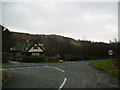
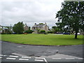
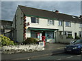
Photos of Natland


Area Information
Natland is a small, built-up area situated in England, covering a total of 30.9 hectares. This compact footprint suggests a close-knit community where residents know their local surroundings intimately. The specific geography of this locality creates a distinct pace of life that differs significantly from larger towns or sprawling cities. You will find a setting where the proximity of homes means neighbours are often within sight or sound. The area functions as a cohesive unit rather than a dispersed collection of estates. Daily life here revolves around a combination of local sustenance and travel to nearby services, given the limited size of the settlement itself. The character of this place is defined by its modest scale and established nature. Living in Natland offers a retreat from the density of urban centres while maintaining access to essential regional infrastructure. You should expect a lifestyle characterised by quietude and a strong sense of territorial identity. The area serves as a home for many who value a lower-volume environment without complete isolation. Your focus will be on the immediate neighbourhood and the connections stretching just beyond it to support your daily routines. This is a place where you live simply, with the world accessible but clearly separated by a defined boundary.
- Area Type
- Built Up Area 250
- Area Size
- 30.9 hectares
- Population
- Not available
- Population Density
- Not available
Your daily convenience in Natland depends on travelling to practical facilities outside the immediate settlement. Several railway stations are within reach, including Oxenholme Lake District Railway Station, Kendal Railway Station, and Burneside Railway Station. These transport hubs provide the linkage needed to access wider regional employment and leisure opportunities. For retail and daily shopping, you have five notable venues nearby, specifically Asda Kendal, Spar Patinum, and Spar. These supermarkets serve as the central nodes for your grocery and household needs. Living in Natland means your lifestyle revolves around a necessary commute to these specific named amenities rather than having them immediately on your doorstep. The convenience of having dedicated railway stations close by offsets the lack of local high-street variety. You will find that your weekly routine involves trips to Asda Kendal for major household stores and potentially to the smaller Spar locations for additional items. This configuration provides a functional, though not plush, lifestyle where essential services are accessible by short travel. The connection to Kendal and Oxenholme embeds you comfortably into the broader transport network of the region.
Amenities
Schools
Families in the area rely on two specific educational institutions nearby: St Mark's CofE Primary School and Appletree School. St Mark's CofE Primary School operates as a primary school and holds a "good" Ofsted rating. Appletree School functions as a special school and also holds a "good" Ofsted rating. This combination of institutions provides a foundational education for children within the local vicinity, though the presence of a special school suggests specific educational needs are addressed in this catchment zone. The school data shows that both facilities maintain a standard rated "good", indicating they meet the required benchmarks for educational provision. Generally, this mix means that younger children attend St Mark's for their primary education before potentially moving to secondary provision elsewhere, as no secondary school is listed. For parents considering schools near Natland, you will find two options with consistent positive ratings. The availability of a special school is a notable feature of the local educational landscape. While you may need to look beyond these two institutions for secondary education, the primary and special education sectors are represented by schools with proven standards. The presence of these specific institutions shapes the local educational environment for any child living in the area.
| Rank | School | Type | Entry gender | Ages |
|---|
Explore more schools in this area
Go to Schools tabDemographics
The community in Natland displays a very specific age profile with a median age of 70 years. This indicates that the population is predominantly composed of older individuals, likely reflecting the tenure structure of the houses available. You will find a neighbourhood that is largely occupied by mature residents rather than young families or working-age professionals seeking their first steps on the property ladder. The level of home ownership stands at an exceptionally high rate of 86%, confirming that the vast majority of residents live in properties they own. This statistic paints a clear picture of a stable, established community where tenants are a small minority. Accommodation types and household compositions follow directly from this dominance of owner-occupied stock, meaning you are looking at a demographic with deep roots in the location rather than transient populations. The lack of significant rental figures suggests that buying a home here has historically been the primary route to living in the area. This demographic makeup means the local culture is likely shaped by long-term residents who understand the history and practicalities of the area. When you consider the community in Natland, you are looking at a group that values stability and permanence over mobility.
Household Size
Accommodation Type
Tenure
Ethnic Group
Religion
Household Composition
Age
Household Deprivation
NS-SEC
Explore more demographic insights in this area
Go to Demographics tabPlanning
Planning Constraints
- Crime RiskPremium