Area Overview for Nantwich South and Stapeley Ward
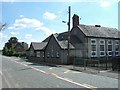
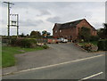
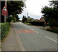
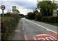
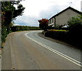
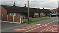
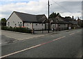
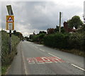
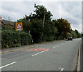
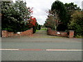
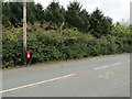
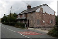
Photos of Nantwich South and Stapeley Ward
Area Information
Nantwich South and Stapeley Ward occupies 8.3 square kilometres in the North West of England, functioning as a transition point from a rural agricultural parish to a dormitory suburb of Nantwich and Crewe. The ward encompasses the hamlet of Stapeley, located approximately two and a quarter miles south-east of the market town, alongside settlements including Broad Lane, Butt Green, Artle Brook, Haymoor Green, and Howbeck Bank. With a population of roughly 3,217 residents, the area reflects the character of a residential community that has shifted dramatically since the late 20th century. The construction of the Cronkinson Farm housing estate in the 1990s, comprising over 1,000 homes, fundamentally altered the parish from a rural backwater into a key living area for commuters. You will find that life here revolves around the nearby market town of Nantwich, famous historically for its salt production and cheesemaking industries. The ward extends to include a residential development north of the A5301 adjacent to Nantwich, solidifying its role as an extended suburb rather than an isolated village. Residents enjoy proximity to turnpike roads developed in the 18th century, which historically stimulated commercial activity along Broad Lane. Today, these routes provide essential access, while historic landmarks like the Broad Lane Primitive Methodist chapel remain visible reminders of the area's long history dating back to the Domesday survey as Steple. Living in Nantwich South and Stapeley Ward means balancing a small hamlet atmosphere with modern connectivity to larger urban centres.
- Area Type
- District Borough Unitary Ward
- Area Size
- 8.3 km²
- Population
- 3217
- Population Density
- 386 people/km²
Demographics
The community within Nantwich South and Stapeley Ward skews significantly older, with a median age of 70 years. This demographic profile indicates a neighbourhood where residents are likely to require accessible homes or support services tailored to an elderly population. Home ownership stands at 74% of total households, placing this ward in a strongly owner-occupied category. Such high ownership rates suggest a stable community where residents often stay for generations, fostering deep local roots. While the data does not specify percentages for different household compositions or predominant ethnic groups, the age profile strongly implies a retiree-heavy environment. You should expect a quiet atmosphere where the pace of life is generally slower than in more vibrant, younger urban areas. The population density averages 386 people per square kilometre, which is moderate for a unitary ward in Cheshire East. This density supports local facilities without creating the congestion found in city centres. The mix of accommodation types remains consistent throughout the 8.3 square kilometre area, reflecting the blend of historic rural housing and the modern estate developments introduced in the 1990s. Understanding the age distribution is crucial for families considering school locations or for individuals seeking a retirement home. The area's demographic makeup ensures that community events and services will cater primarily to mature residents and their needs.
Household Size
Accommodation Type
Tenure
Ethnic Group
Religion
Household Composition
Age
Household Deprivation
NS-SEC
Explore more demographic insights in this area
Go to Demographics tabPlanning
Planning Constraints
- Flood RiskPremium
- Ramsar Wetland SitesPremium
- Area of Outstanding Natural BeautyPremium
- Protected Nature ReservePremium
- Protected WoodlandPremium
- Crime RiskPremium