Area Overview for Mossy Lea
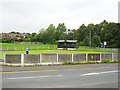
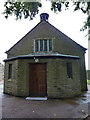
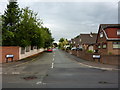
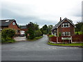
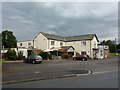
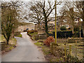
Photos of Mossy Lea


Area Information
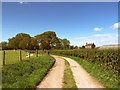
Mossy Lea is a built-up area located within Greater Manchester, England, covering a total footprint of 23.4 hectares. This compact urban settlement sits within the Wylde Green and Westhoughton ward, forming part of the Pendlebury community. Living in Mossy Lea means navigating a small, self-contained environment where daily routines rely heavily on local access rather than extensive travel. The area functions as a residential cluster without the scale of a traditional town centre, offering quiet streets and a close-knit character typical of provincial England. Residents benefit from proximity to larger transport hubs and retail corridors while maintaining a semi-rural backdrop. Daily life here revolves around the practicalities of suburban living. You are not relying on village amenities but instead have access to broader nearby towns through established transport links. The community feels established, with long-term residents and higher home-ownership rates shaping the local culture. While Mossy Lea lacks the bustle of a city centre, it provides a functional base for those seeking accessibility to greater Manchester without the associated congestion or cost of living. The location serves as a stepping stone, balancing residential calm with reasonable connectivity to the wider region's economic and social opportunities.
- Area Type
- Built Up Area 250
- Area Size
- 23.4 hectares
- Population
- Not available
- Population Density
- Not available
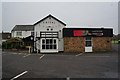
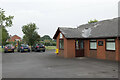
Residents of Mossy Lea enjoy convenient access to a range of retail and transport amenities within practical reach. For daily shopping needs, there are five notable retail locations nearby, including Waitrose at, Asda Standish, and Co-op Coppull. These supermarkets and local stores provide most of the essentials for your household without requiring a long journey into the city centre. Beyond groceries, the area is well served by rail with five stations within close proximity, including Appley Bridge Railway Station, Parbold Railway Station, and Gathurst Railway Station. These transport links are the backbone of your lifestyle in Mossy Lea, offering easy access to the wider network. You can reach major employment hubs in Greater Manchester relatively quickly, bypassing the need for a car for daily commutes. The combination of local supermarkets and excellent rail access means you can shop and travel independently. There is no mention of dedicated parks, leisure centres, or dining venues within the immediate data, so your lifestyle choices rely on these outward-facing connections. Your weekend activities would likely involve trips to Standish or Coppull for more extensive leisure options, making the built-up area a residential base rather than a full-service destination.
Amenities
Schools
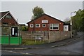
Families living in Mossy Lea have educational options primarily anchored by Wrightington Mossy Lea Primary School. This state-funded institution serves the local community and holds a 'good' rating from Ofsted, indicating it meets solid standards in education and care. There are no secondary schools listed immediately adjacent to the built-up area within the immediate proximity data provided. This means older children in the Mossy Lea area will likely need to travel to secondary institutions in neighbouring wards or towns. The reliance on a single primary school suggests a focused educational ecosystem where local priorities centre on early childcare and primary education. Parents considering homes near Mossy Lea must weigh the strong performance of this primary option against the logistical realities of secondary schooling. The 'good' rating provides reassurance for families, but the absence of listed secondary options implies that commuting to schools like those in Wigan or Westhoughton may be part of the daily routine. There are no special education or sixth-form colleges mentioned in the immediate vicinity, placing the burden of secondary education transport on the family.
| Rank | School | Type | Entry gender | Ages |
|---|
Explore more schools in this area
Go to Schools tabDemographics
The community in Mossy Lea is defined by an older demographic, with a median age of 70 years. Age groups are less diverse, with the majority of residents falling into the broad 'Total' age category rather than specific young or middle-aged brackets. This profile suggests a neighbourhood populated largely by established residents who have lived in the area for a significant portion of their lives. Home ownership stands at an exceptionally high level of 86%, indicating that most households in Mossy Lea are owner-occupiers rather than tenants or landlords. Accommodation types reflect this stability, with most homes purchased or inherited rather than rented. There is little evidence of a transient population, and the area does not cater specifically to young professionals or students. The ethnic makeup and religious composition of the population are recorded under total categories, implying a homogenous community where diversity is not a defining statistical feature. Living in Mossy Lea means joining a static community where neighbours know one another over decades. The high ownership rate also suggests that the housing stock has been settled for a long time, with fewer speculative developments or recent property turnovers compared to other parts of Manchester.
Household Size
Accommodation Type
Tenure
Ethnic Group
Religion
Household Composition
Age
Household Deprivation
NS-SEC
Explore more demographic insights in this area
Go to Demographics tabPlanning
Planning Constraints
- Crime RiskPremium