Area Overview for Mossley Hill Ward
Photos of Mossley Hill Ward


Area Information
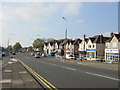
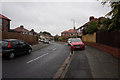
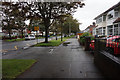
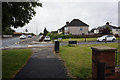
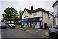
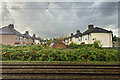
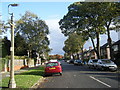
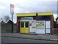
Mossley Hill Ward represents a distinct suburb of Liverpool, covering 1.3 square kilometres with a population of 1,266 residents. You will find this ward situated 3.5 miles southeast of the city centre, bordered by Aigburth, Allerton, Childwall, and Wavertree. Its boundaries were refined in 2023 to include areas along Elmswood Road, the West Coast Mainline, and Aigburth Road. The ward encompasses specific landmarks such as Sudley House, the John Moores University I.M. Marsh Campus, and Mossley Hill railway station. Despite the 2021 census recording a ward population of 12,041, the specific demographic data for this unitary ward indicates a smaller current resident count of 1,266 individuals. As part of the Liverpool Wavertree Parliamentary constituency, the area offers a blend of residential streets and institutional sites. You can access local history through Greenbank Park, which was established by the Rathbone family in 1897 as public open space. The ward also hosts the Islamic Institute and various places of worship. Daily life here revolves around a semi-detached and terraced housing stock, alongside businesses serving the community. The presence of Mossley Hill Hospital, now an 80-bed NHS facility operational since late 2025, adds a significant healthcare element to the locality. This concentration of amenities and transport links defines the character of living in Mossley Hill Ward.
- Area Type
- District Borough Unitary Ward
- Area Size
- 1.3 km²
- Population
- 1266
- Population Density
- 960 people/km²
Demographics
The community profile for Mossley Hill Ward reveals a population dominated by older residents. The median age sits at 70 years, meaning half of the 1,266 people are older than this age. This age profile suggests a neighbourhood where retirement and established families likely play a major role in local life. Home ownership is exceptionally high within the ward, with 91 per cent of households owning their homes outright or with a mortgage. This figure indicates a stable community where long-term residents have invested deeply in their properties. Regarding household composition and accommodation type, the provided overview for the area confirms that Mossley Hill features a mix of housing forms typical of affluent suburbs. You will find semi-detached and detached homes alongside terraced streets. The area contains 1.3 square kilometres of land, supporting this specific population density. While the most common age range data is listed as total, the median figure clearly places this as a mature demographic area. Ethnic diversity, predominant religious groups, and detailed household breakdowns are not broken out in the available statistics for this specific ward unit. Consequently, the available data paints a picture of a homogenous, owner-occupied environment where the primary demographic characteristic is an advanced age profile.
Household Size
Accommodation Type
Tenure
Ethnic Group
Religion
Household Composition
Age
Household Deprivation
NS-SEC
Explore more demographic insights in this area
Go to Demographics tabPlanning
Planning Constraints
- Flood RiskPremium
- Ramsar Wetland SitesPremium
- Area of Outstanding Natural BeautyPremium
- Protected Nature ReservePremium
- Protected WoodlandPremium
- Crime RiskPremium