Area Overview for Moss Bay and Moorclose Ward
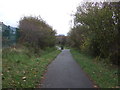
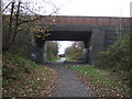
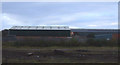
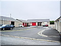
Photos of Moss Bay and Moorclose Ward
Area Information
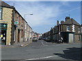
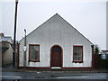
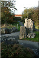
Moss Bay and Moorclose Ward is a coastal district within the Allerdale borough of Cumbria, covering a total area of 2.9 square kilometres. It sits near Workington in West Cumbria and forms part of the urban landscape adjacent to the Solway coast. The ward is often grouped with nearby Salterbeck and is bounded by official district lines. This neighbourhood developed as an urban area but has faced significant challenges in recent decades. The closure of local steel works transformed the local economy, leading to long-term unemployment and social decline. You will find a community that has worked hard to address these issues through initiatives like the Solway Views group, which focused on employment vulnerability and health inequalities between 2017 and 2019. Daily life here involves navigating the realities of a post-industrial town. Residents often deal with isolation from other parts of Cumbria and difficulties accessing services. The area contains specific landmarks such as a football ground and the Mossbay Allotment Gardens, which serve as local gathering points. While the ward offers the distinct character of a coastal settlement, the legacy of industrial closure shapes its social fabric. You are looking at a labour force with high vulnerability to job loss and a population facing genuine financial pressures. The terrain includes an urban zone that feels close to the water, yet the transport links required to reach wider opportunities remain difficult and expensive. Living in Moss Bay and Moorclose Ward means accepting these structural limitations while engaging with a resilient local community.
- Area Type
- District Borough Unitary Ward
- Area Size
- 2.9 km²
- Population
- Not available
- Population Density
- Not available
Demographics
The community in Moss Bay and Moorclose Ward is dominated by an older population. The median age for residents is 70 years, indicating a significant demographic shift towards retirement or older age groups. Despite the data listing "Age: Total" as the most common age range descriptor, the median figure of 70 strongly suggests that most households consist of older individuals. Financial concerns are prevalent, with high rates of unemployment linked to the historic closure of the steel industry affecting the demographic makeup. Home ownership stands at 42 per cent, meaning the majority of residents rent rather than own their homes. This high rental proportion reflects the economic instability and historical deprivation within the ward. Household composition data is available only as a general total category in the provided records, so specific details on single-person versus family households are not itemised. Similarly, information regarding predominant ethnic groups, religious affiliation, and precise household breakdowns is not included in the current dataset. You cannot rely on fine-grained demographic splits beyond the age median and ownership split. The area faces documented social and environmental decline, including feelings of loneliness among residents. Financial worries are a stated reality for many people living in this ward. Deprivation is evident through the loss of local manufacturing jobs and the resulting reliance on limited public services. The population structure reflects a working-age workforce that is particularly vulnerable to job challenges, alongside an aging resident base. When examining who lives here, you see a mix of those relying on rental income and an older demographic navigating life well past retirement age.
Household Size
Accommodation Type
Tenure
Ethnic Group
Religion
Household Composition
Age
Household Deprivation
NS-SEC
Explore more demographic insights in this area
Go to Demographics tabPlanning
Planning Constraints
- Flood RiskPremium
- Ramsar Wetland SitesPremium
- Area of Outstanding Natural BeautyPremium
- Protected Nature ReservePremium
- Protected WoodlandPremium
- Crime RiskPremium