Area Overview for Meols
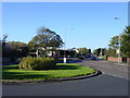
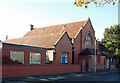
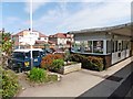
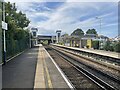
Photos of Meols


Area Information
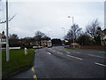
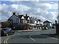
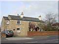
Meols is a built-up area covering 1.6 square kilometres in England. It stands as an established residential community where daily life revolves around local amenities and reliable transport links. The neighbourhood balances a strong sense of local identity with practical access to the wider region. Residents enjoy proximity to key railway stations and ferry terminals, which connect the area directly to Birkenhead, Seacombe, and Woodside. This accessibility defines the routine for many households. You can walk to several retail outlets or catch a train from Meols Railway Station to catch connections further afield. The location feels secure and manageable, fitting the needs of those who value a settled existence. While the area remains intimate, its strategic position ensures you are never truly isolated from urban services. Living in Meols means adopting a lifestyle that prioritises stability and convenience. You benefit from a compact footprint that keeps daily errands short and straightforward. The area offers a quiet retreat without sacrificing access to essential services.
- Area Type
- Built Up Area 250
- Area Size
- 1.6 km²
- Population
- Not available
- Population Density
- Not available
Daily life in Meols benefits from immediate access to a range of retail and transport amenities. Residents have five notable shopping destinations nearby, including Morrisons Daily, Co-op Hoylake, and Sainsburys Hoylake. These supermarkets cover your essential grocery and household shopping needs without requiring a long journey. Transport links are equally well developed with five railway stations in close reach, such as Meols Railway Station and Manor Road Railway Station. Furthermore, three ferry terminals provide direct links to Birkenhead, Seacombe, and Woodside. This combination of rail and sea travel offers diverse commuting options. You can choose between a quick train ride or a scenic ferry crossing depending on your destination. The concentration of retail and transport hubs means your daily errands are convenient and efficient. Living in Meols gives you the ability to run errands, shop for food, and travel without significant detours.
Amenities
Schools
Families moving to Meols will find two primary school options within close proximity. Great Meols Primary School offers education to younger children in the area and holds an Ofsted rating of good. This rating confirms that the school meets high standards of educational quality. For those seeking an independent education, Kingsmead School provides an alternative pathway for students. The presence of one state-funded primary school with a positive assessment and one private option gives families flexibility. However, the specific catchment areas or prefectures for these institutions are not detailed in the current data. What is clear is that the local education infrastructure supports primary schooling directly within the neighbourhood. Parents can rest assured that Great Meols Primary School operates under a good rating, offering a solid foundation for their children. The mix of state and independent schools means you can choose the educational environment that best suits your family.
| Rank | A + A* % | School | Type | Entry gender | Ages |
|---|---|---|---|---|---|
| 1 | N/A | Great Meols Primary School | primary | N/A | N/A |
| 2 | N/A | Kingsmead School | independent | N/A | N/A |
| 3 | N/A | Great Meols Primary School | primary | N/A | N/A |
Explore more schools in this area
Go to Schools tabDemographics
The community in Meols reflects a demographic profile dominated by older residents. The median age stands at 70 years, confirming that the population skews significantly towards retirees and mature adults. Mortality and morbidity trends are likely influenced by this age structure, yet the embedded sense of community remains strong. Home ownership is exceptionally high at 82%, indicating that most people have purchased their properties outright or with existing mortgages rather than renting. This high rate of ownership suggests long-term settlement where families build roots across generations. Household composition varies, but the data confirms a total household count that supports this settled environment. The area does not display specific breaks down for accommodation types or predominant ethnic groups in the provided records, so the focus remains on the clear dominance of older age ranges and owner-occupiers. This demographic reality means you are joining a neighbourhood where stability and established routines are the norm.
Household Size
Accommodation Type
Tenure
Ethnic Group
Religion
Household Composition
Age
Household Deprivation
NS-SEC
Explore more demographic insights in this area
Go to Demographics tabPlanning
Planning Constraints
- Crime RiskLocked