Area Overview for Matterdale
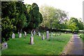
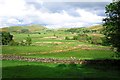
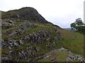
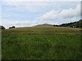
Photos of Matterdale


Area Information
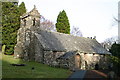
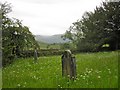
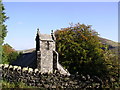
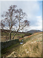
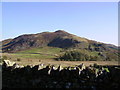
Matterdale is a civil parish located within the Eden district of Cumbria, situated in the historic county of Cumberland. This rural community covers a significant area of 68.9 square kilometres. It was designated as an ecclesiastical parish in 1742, originating from the larger Greystoke ancient parish. Later administrative changes expanded its boundaries in 1934 when it absorbed Watermillock civil parish. The parish encompasses several distinct settlements, including Dockray, Matterdale End, Ulcat Row, Watermillock, and Wreay. Locals refer to it as a chapelry and township that now forms a cohesive residential entity. Living in Matterdale means you reside in a location with deep historical roots, where the settlement patterns reflect over three centuries of development. The area offers a traditional village life characterised by its specific historical lineage rather than modern urban expansion. Residents here experience daily life defined by its status as an established parish within the wider Cumbrian landscape. The community functions as both a chapelry and a township, maintaining connections to its Greystoke origins while operating as an independent civil parish. You will find that the parish(mouse) heritage guides and local historical records from the Cumbria County History project often detail these administrative shifts. This background provides a stable framework for understanding the local governance and community structure. Whether you are exploring homes in Matterdale or visiting the nearby settlements, the historical context shapes the local identity and landscape management.
- Area Type
- Parish
- Area Size
- 68.9 km²
- Population
- Not available
- Population Density
- Not available
Demographics
The community profile in Matterdale indicates a mature population structure with a distinct age demographic. The median age for residents sits at 70 years old. Data confirms that the age distribution reflects a predominantly older cohort. While the most common recorded age category is labelled as "Total" in the available records, the central tendency strongly suggests a retirement or senior citizen population rather than families with young children. Regarding household composition, the specific breakdown by family types is not detailed in the current records. Similarly, detailed statistics on predominant ethnic groups and religious affiliations are not currently provided in the data. Home ownership levels present a clear financial picture for the local market. Three quarters of all households own their properties, with a home ownership rate of 73%. This figure significantly exceeds the national average for many English regions, indicating a stable property base where long-term residents have secured equity. The high ownership percentage suggests that the local housing market is driven by ownership rather than rental investment or temporary occupancy. This stability often correlates with communities where families have lived for generations and few houses change hands annually. The presence of such a high ownership rate means that the market may move slower than in cities, with buyers seeking properties to settle in for the long term.
Household Size
Accommodation Type
Tenure
Ethnic Group
Religion
Household Composition
Age
Household Deprivation
NS-SEC
Explore more demographic insights in this area
Go to Demographics tabPlanning
Planning Constraints
- Flood RiskPremium
- Ramsar Wetland SitesPremium
- Area of Outstanding Natural BeautyPremium
- Protected Nature ReservePremium
- Protected WoodlandPremium
- Crime RiskPremium