Area Overview for Marsh Ward
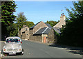
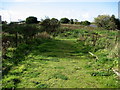
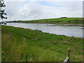
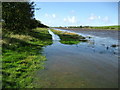
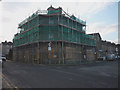
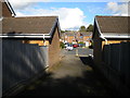
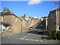
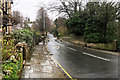
Photos of Marsh Ward


Area Information
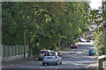
Marsh Ward is a compact district covering 1.9 km² in England. Despite its small footprint, it hosts a distinct community with specific characteristics that define resident life. The area stands out for its older demographic makeup and high level of home ownership. Living in Marsh Ward means navigating an environment where age and ownership patterns shape the local rhythm. You will find that the community is significantly older than many other parts of the country. The median age reaches seventy years, indicating a settled population rather than a young, transient workforce. This tends to create a quieter atmosphere compared to more youthful neighbourhoods. Most residents have owned their homes for a long time, securing stability within these boundaries. The median age figure of seventy is a defining trait of this specific ward. When considering homes in Marsh Ward, expect to engage with a demographic focused on later life rather than raising young families. The small area size confines the total population density, which may influence social interactions and local services. Your daily life here will be shaped by these clear demographic realities. The area does not offer the vibrancy of a bustling student hub or a millennial rooftop scene. Instead, the focus remains on established households and long-term residents.
- Area Type
- District Borough Unitary Ward
- Area Size
- 1.9 km²
- Population
- Not available
- Population Density
- Not available
Demographics
The community profile of Marsh Ward reveals a settlement dominated by older residents. Your understanding of who lives here becomes clear when observing the statistics provided. The median age sits at seventy years, cementing the area's identity as a haven for the elderly. Sixty-one per cent of households in Marsh Ward are owner-occupied, a figure that highlights stable tenure within the district. This high ownership rate suggests that most people in Marsh Ward have deep roots in the neighbourhood. Accommodation types and household composition data confirm that the majority of dwellings serve established families or individuals in retirement. The ethnicity and religion sections of the data do not provide specific breakdown figures, but the overall demographic picture points toward a traditional settlement structure. Deprivation metrics are not included in the current dataset, so any assessment of economic hardship remains outside the scope of available facts. What you do know is that the social fabric has aged considerably. Most common age ranges cluster around this high median, meaning you will frequently encounter neighbours who have lived here for decades. This stability creates predictable community dynamics. You are not entering an area of rapid migration or shifting demographic tides. The fixed nature of the population offers a clarity of purpose for anyone seeking a quiet retirement location or looking to understand the historical layout of the ward.
Household Size
Accommodation Type
Tenure
Ethnic Group
Religion
Household Composition
Age
Household Deprivation
NS-SEC
Explore more demographic insights in this area
Go to Demographics tabPlanning
Planning Constraints
- Flood RiskPremium
- Ramsar Wetland SitesPremium
- Area of Outstanding Natural BeautyPremium
- Protected Nature ReservePremium
- Protected WoodlandPremium
- Crime RiskPremium