Area Overview for Marple
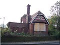
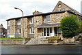
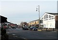
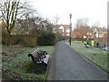
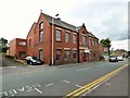
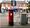
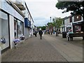
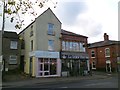
Photos of Marple

Area Information
Marple is a built-up area in England covering 3.7 km² with a population of 1318. The small footprint creates a contained community where residents know the local streets and amenities well. With a population density of 352 people per square kilometre, the area maintains a residential character while retaining easy access to broader transport links. This sized locality often appeals to those seeking a specific quiet environment without the isolation of larger parishes. The demographic profile suggests a mature living environment, indicated by the area's median age of 70. Daily life here revolves around established neighbourhood centres and direct rail connections to Manchester. You will find the area functions as a distinct local hub rather than a sprawling suburb. The combination of small area size and focused population means services are concentrated and reachable on foot or by short drive. Prospective homebuyers will note this density supports immediate access to local retail and transport without navigating complex urban centres. The area stands as a defined residential zone within Greater Manchester, offering a clear sense of place for those intending to settle down. Living in Marple means accepting a compact, well-defined community structure that prioritises established neighbourhood ties over rapid expansion or demographic turnover.
- Area Type
- Built Up Area 250
- Area Size
- 3.7 km²
- Population
- 1318
- Population Density
- 352 people/km²
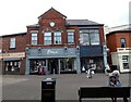
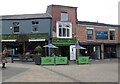
Daily life in Marple centres on five retail outlets and accessible rail stations. Shoppers can visit Asda Marple, Co-op Marple, and Iceland Marple for everyday essentials. These three specific supermarkets provide a convenient base for weekly grocery runs without needing to travel far from home. The presence of these major chains means you can find fresh food, household supplies, and pre-packaged meals locally. Rail links through Rose Hill Marple Railway Station, Marple Railway Station, and Romiley Railway Station ensure straightforward journeys to neighbouring towns. Manchester Woodford Airport is within practical reach for those with private aviation needs. These amenities create a self-sustaining locality where basic needs are met without extensive travelling. You will appreciate having a Co-op and Asda within a short distance for budget-conscious shopping or quick top-ups. The five retail units listed represent the core commercial heartbeat of the area. Leisure activities may be limited outside of shopping, but the convenience of having these stores nearby saves significant commute time. This layout supports a quiet lifestyle where errands are manageable. The accessibility of these named venues defines the independent nature of life in Marple. Residents do not need to drive far for groceries or travel planning compared to those in remote parishes.
Amenities
Schools
Families moving to Marple can access a selection of primary schools in the immediate vicinity, though no secondary schools appear in the local list. Nearby options include Doodfield Primary School, Peacefield Primary School, and The Dale Primary School. Both Rose Hill Primary School and All Saints Church of England Primary School Marple hold a 'good' Ofsted rating. This distinction confirms quality standards at these specific institutions for pupils within the identified catchment or nearby zones. The concentration of primary schools suggests Marple serves as a feeder area for local infants and reception-aged children. You will find no specialist academies or comprehensive secondary schools listed within this data set for the immediate area. Commuters with older children may need to look outside the 3.7 km² boundary for secondary education. The 'good' ratings at Rose Hill and All Saints indicate reliable educational provision for younger students. Parents should verify current catchment boundaries with local authorities, as school intake relies on precise postcode geography. The presence of multiple primary options gives families some choice without the competition found in larger town centres. These schools form the core educational infrastructure for the younger segment of the local population before they advance to higher levels elsewhere.
| Rank | A + A* % | School | Type | Entry gender | Ages |
|---|---|---|---|---|---|
| 1 | N/A | Doodfield Primary School | primary | N/A | N/A |
| 2 | N/A | Peacefield Primary School | primary | N/A | N/A |
| 3 | N/A | Rose Hill Primary School | primary | N/A | N/A |
| 4 | N/A | The Dale Primary School | primary | N/A | N/A |
| 5 | N/A | All Saints Church of England Primary School Marple | primary | N/A | N/A |
Explore more schools in this area
Go to Schools tabDemographics
The community in Marple displays a distinct age profile with a median age of 70. This statistic indicates a senior-heavy population compared to the national average. Eighty-one per cent of residents own their homes, placing Marple firmly in the owner-occupied category. This high level of ownership suggests long-term settlement rather than a transient housing market. The household composition data reflects a total count but points towards smaller, often single-occupancy or two-occupancy households typical of retirement communities or couples in later life. Accommodation types are consistent with this ownership model, focusing on detached and semi-detached properties common to older areas. Although specific ethnicity and religion statistics are not provided in the current dataset, the high ownership rate of 81% strongly correlates with stability. The age distribution implies a slower pace of life and a need for age-friendly services. You should consider whether the local environment meets the specific mobility or healthcare needs associated with an older demographic. The lack of young family clusters in the data suggests fewer school-age children reside permanently within what are effectively very small 1318 population boundaries. This demographic reality shapes the local mood, making Marple a quieter, more sedate location suited to established residents.
Household Size
Accommodation Type
Tenure
Ethnic Group
Religion
Household Composition
Age
Household Deprivation
NS-SEC
Explore more demographic insights in this area
Go to Demographics tabPlanning
Planning Constraints
- Crime RiskLocked