Area Overview for Marbury Ward
Photos of Marbury Ward
Area Information
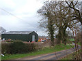
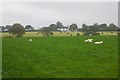
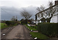
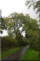
Living in Marbury Ward offers a rural lifestyle anchored by a small population of 1,225 residents spread across 69.9 square kilometres. This extensive area creates a low-density environment with a population density of just 18 people per square kilometre, ensuring your days are spent amidst undulating terrain rather than urban congestion. The land rises from 75 metres near the Llangollen Canal to 120 metres, hosting mostly agricultural dairy farming and defining the parish's character. Administratively, this ward sits within Cheshire West and Chester, having undergone boundary changes in 2011 that merged historic parishes into Marbury and District in 2023. You will find the village centred at a distinctive T-junction connecting Hollins Lane, Wirswall Road, and Wrenbury Road. Life here follows a slower pace, dominated by the green tranquillity of the Wirswall/Marbury/Combermere Area of Special County Value. The village itself holds the status of a conservation area, designated in 1973, which protects the historic architecture and spatial layout of the community. The northern border is lined by a branch of the Shropshire Union Canal, featuring grade-II-listed assets like Church Bridge and Quoisley Lock. For buyers seeking the quiet countryside within North West England, Marbury provides access to open fields and ancient parkland linked to Combermere Abbey without the noise of a nearby town centre.
- Area Type
- District Borough Unitary Ward
- Area Size
- 69.9 km²
- Population
- 1225
- Population Density
- 18 people/km²
Demographics
The community of Marbury Ward is defined by its mature demographic profile, with a median age of 70 years. This data indicates a population skewed significantly towards older residents, a common trait in rural villages where young families often migrate to urban centres. You will find that 80% of households are owner-occupied, reflecting strong community stability and a lack of transient tenancy rates. This high level of home ownership suggests long-term residency, which can foster tight-knit local relations but may also imply slower turnover for property sales. The area is predominantly rural, meaning the household composition leans towards older couples or single adults living in detached or semi-detached properties suited to agricultural surroundings. While the provided data does not specify ethnic or religious breakdowns, the demographics align with a traditional English village structure. Deprivation indicators are not explicitly quantified in the available statistics, yet the low population density and active home ownership often correlate with limited access to centralised services found in larger urban districts. The quiet nature of the ward, with its mostly agricultural land use, means daily life revolves around local village amenities rather than commercial hubs, fitting the preferences of those who prioritise rural retirement or countryside living over urban conveniences.
Household Size
Accommodation Type
Tenure
Ethnic Group
Religion
Household Composition
Age
Household Deprivation
NS-SEC
Explore more demographic insights in this area
Go to Demographics tabPlanning
Planning Constraints
- Flood RiskLocked
- Ramsar Wetland SitesLocked
- Area of Outstanding Natural BeautyLocked
- Protected Nature ReserveLocked
- Protected WoodlandLocked
- Crime RiskLocked