Area Overview for Marbury and District
Photos of Marbury and District

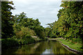
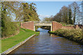
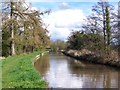
![Steer Bridge [No 24], from the east in Marbury and District](https://images.propbar.co.uk/images/geograph/52/19/5219631_120.jpg)

Area Information
Marbury and District is a civil parish in England covering 19.0 square kilometres. The area offers a distinct living environment defined by its rural character and established community. Residents enjoy a setting where the land remains largely open, with no coverage of Areas of Outstanding Natural Beauty or protected nature reserves within its boundaries. However, potential buyers must note that the parish contains Ramsar wetland sites, a planning constraint that may influence future development. Daily life here involves navigating a landscape of significant historical permanence alongside specific environmental sensitivities. If you are considering living in Marbury and District, you are entering an established community rather than a rapidly modernising urban centre. The absence of major protected green designations means the local planning landscape focuses primarily on the preservation of the wetlands identified in official assessments. This creates a unique context where standard development goals meet strict conservation requirements. You should expect a straightforward environment with minimal interference from complex protected status issues, provided you stay clear of the designated wetland areas. The small footprint of the parish ensures that every corner of the land is known and classified, giving you full clarity on the constraints you face before signing any purchase agreement.
- Area Type
- Parish
- Area Size
- 19.0 km²
- Population
- Not available
- Population Density
- Not available
Demographics
The community within Marbury and District is dominated by an older, settled population. The median age of residents is 70, reflecting a village that has hosted long-term families for generations. This demographic profile indicates a neighbourhood where retirement and established households are the norm rather than new arrivals. You will find that 77 per cent of dwellings are owner-occupied, a figure that underscores the stability of tenure in the parish. This high level of home ownership contrasts with areas where rental markets drive turnover. The household composition data suggests a total resident base where families and individuals have put down deep roots. While the data does not specify breakdowns for accommodation types or predominant ethnic groups, the overarching picture is one of consistency and continuity. Deprivation levels are not explicitly detailed in the available records, but the high home ownership rate often correlates with areas of lower financial mobility or higher asset concentration. When you look at homes in Marbury and District, you are looking at properties that have changed hands relatively few times. This demographic reality means local businesses and community groups cater primarily to an older age range, creating a service environment tailored to established needs rather than a transient youth culture.
Household Size
Accommodation Type
Tenure
Ethnic Group
Religion
Household Composition
Age
Household Deprivation
NS-SEC
Explore more demographic insights in this area
Go to Demographics tabPlanning
Planning Constraints
- Flood RiskPremium
- Ramsar Wetland SitesPremium
- Area of Outstanding Natural BeautyPremium
- Protected Nature ReservePremium
- Protected WoodlandPremium
- Crime RiskPremium